 by
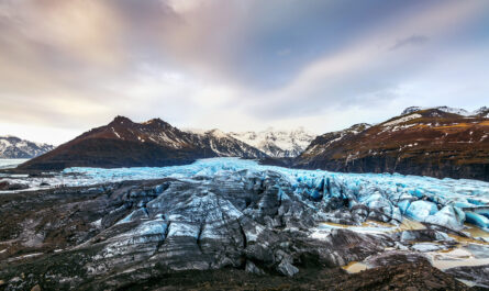
by Glaciers are dynamic, awe-inspiring features of the Earth’s surface, holding vital clues about climate change, sea-level rise, and regional hydrology. Yet, despite their grandeur, glaciers are not static; they move, shrink, grow, and sometimes even surge dramatically. Understanding these changes requires precise measurement techniques, ranging from simple stakes planted on the ice to sophisticated satellite imaging. This article explores the fascinating methods scientists use to measure glaciers, their evolution over time, and the critical insights these measurements provide.
Why Measure Glaciers?
Before diving into the methods, it’s important to understand why scientists study glaciers so closely. Glaciers serve as indicators of climate and environmental health. Some key reasons for measuring glaciers include:
- Monitoring Climate Change: Glaciers are highly sensitive to temperature and precipitation changes. Shrinking glaciers are often the first visible signs of global warming.
- Water Resource Management: Glaciers store freshwater and feed rivers, impacting agriculture, hydroelectric power, and drinking water supplies.
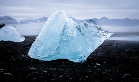
- Predicting Sea-Level Rise: Melting glaciers contribute to rising sea levels, which can threaten coastal communities.
- Understanding Glacial Dynamics: Measurements help scientists study glacier flow, erosion, and interactions with the surrounding landscape.
In short, accurate glacier measurement is essential for both scientific understanding and practical planning.
Early Glacier Measurement Techniques
The study of glaciers has a long history. Early methods were simple yet effective, relying on manual observation and basic tools.
1. Stakes and Ablation Lines
One of the earliest methods for measuring glacier movement and melt involved placing stakes in the ice. Scientists would drive wooden, metal, or bamboo stakes vertically into a glacier at regular intervals. Over time, they would:
- Measure Snow Accumulation: By measuring the snow and ice height around the stake at the end of a season, scientists could determine how much snow had accumulated.
- Measure Ablation (Ice Loss): By noting how much of the stake became exposed as ice melted, they could calculate ice loss.
- Track Movement: By recording the stake’s position relative to nearby markers over time, scientists could calculate glacier velocity.
This simple method is still in use today, especially on smaller glaciers, because it provides direct, reliable data on accumulation and ablation rates.
2. Photogrammetry
Before satellites existed, photogrammetry—a technique using photographs to measure distances—allowed scientists to track glacier changes. Researchers would take overlapping photos of glaciers from fixed points or airplanes. By analyzing the images, they could determine:
- Glacier length and area changes over time.
- Surface features like crevasses and moraines.
- Flow patterns by comparing sequential images.
Photogrammetry was a major advancement because it enabled large-scale measurements without physically walking every part of the glacier.
Modern Ground-Based Methods
While traditional techniques are still valuable, modern technology has expanded the range and precision of glacier measurement.
1. GPS Surveying
Global Positioning System (GPS) devices have revolutionized glacier studies. Scientists attach GPS receivers to stakes or carry handheld units while walking along the glacier. This allows for:
- Tracking Glacier Movement: High-precision GPS can measure ice flow rates down to centimeters per day.
- Mapping Surface Elevation: Scientists can create detailed digital elevation models (DEMs) of the glacier surface.
2. Ground-Penetrating Radar (GPR)
Understanding a glacier’s thickness is as important as knowing its surface movement. Ground-penetrating radar sends radio waves into the ice and measures the time it takes for them to reflect off the bedrock below. This provides:
- Glacier thickness maps.
- Subglacial features, such as crevasses and meltwater channels.
- Data critical for modeling ice dynamics and predicting future changes.
3. Laser Scanning (LiDAR)
LiDAR, or Light Detection and Ranging, is used to measure glacier surfaces with high precision. Scientists mount laser scanners on tripods or aircraft, which emit laser pulses and measure the reflected light. LiDAR enables:
- Creation of highly accurate 3D glacier models.
- Detection of subtle elevation changes over time.
- Tracking of ice surface deformation and flow.
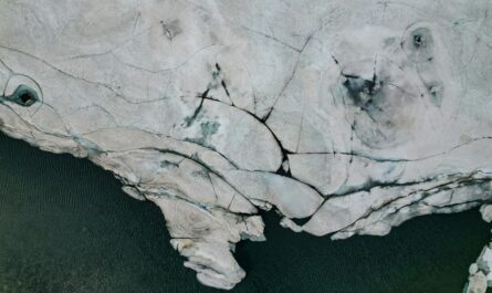
Remote Sensing: Measuring Glaciers from Above
While ground-based methods are invaluable, they are limited by accessibility, safety, and scale. Remote sensing has transformed glacier research, allowing scientists to monitor glaciers worldwide without setting foot on the ice.
1. Satellite Imagery
Satellites equipped with optical, infrared, and radar sensors can capture glacier data from space. Benefits include:
- Global Coverage: Scientists can monitor glaciers in remote or dangerous locations, such as Antarctica or the Himalayas.
- Temporal Monitoring: Satellites like Landsat provide long-term datasets, enabling study of glacier trends over decades.
- Surface Change Detection: By comparing images from different years, scientists can detect changes in glacier area, length, and surface features.
Some commonly used satellite missions for glacier monitoring include Landsat, Sentinel-1, and TerraSAR-X.
2. Synthetic Aperture Radar (SAR)
SAR is a radar technique that can penetrate clouds and operate day or night, making it especially useful in regions with frequent cloud cover. SAR is used to:
- Measure ice velocity by detecting surface motion.
- Monitor glacier deformation and surging events.
- Map ice thickness in combination with other datasets.
3. Interferometry
Interferometric techniques analyze phase differences in radar or laser data from multiple passes over a glacier. This allows scientists to:
- Detect minute surface changes.
- Measure ice flow velocities with high precision.
- Monitor surface elevation changes due to melting or accumulation.
Unmanned Aerial Vehicles (Drones) in Glacier Science
In recent years, drones have become a powerful tool for glacier measurement. Equipped with cameras or LiDAR sensors, drones can:
- Capture high-resolution images for mapping and photogrammetry.
- Survey dangerous or inaccessible areas safely.
- Provide rapid assessments after ice calving events or landslides.
Drones combine the detail of ground-based methods with the broader perspective of satellite observation.
Combining Data for Glacier Monitoring
Modern glacier studies often combine multiple measurement techniques to improve accuracy and understanding. For example:
- Stakes + GPS + Satellite: Provides both local and global flow and melt patterns.
- GPR + LiDAR + SAR: Reveals ice thickness, surface changes, and dynamic flow simultaneously.
- Drones + Photogrammetry: Allows high-resolution mapping of specific features like crevasses or moraines.
By integrating these methods, scientists can create comprehensive models of glacier health, predict future changes, and better understand the impacts of climate change.
Key Insights from Glacier Measurements
Measuring glaciers is not just a technical exercise; it provides vital scientific insights:
- Global Glacier Retreat: Most glaciers worldwide are retreating due to rising temperatures, a trend confirmed by decades of measurement.
- Sea-Level Contribution: Melting glaciers contribute significantly to global sea-level rise, with measurements helping refine predictions.
- Hydrological Changes: Glacier melt affects river flows, water availability, and ecosystems downstream.
- Hazard Prediction: Accurate glacier data can warn of potential hazards like glacial lake outburst floods (GLOFs).
These insights are crucial for policymakers, scientists, and communities dependent on glacial water resources.
Challenges in Measuring Glaciers
Despite advances, measuring glaciers remains challenging:
- Harsh Environments: Cold, wind, crevasses, and avalanches make fieldwork dangerous.
- Remote Locations: Some glaciers are in inaccessible mountain ranges or polar regions.
- Rapid Changes: Glaciers can surge or calve unexpectedly, complicating long-term monitoring.
- Data Integration: Combining diverse datasets from different sensors and scales requires sophisticated analysis and modeling.
Ongoing technological innovation is helping overcome these challenges, making glacier monitoring safer and more effective.
Conclusion
From simple stakes planted on ice to satellites orbiting Earth, the methods scientists use to measure glaciers have evolved dramatically. Each technique, whether ground-based, aerial, or satellite-assisted, provides unique insights into glacier dynamics, health, and future behavior. Measuring glaciers is not just about mapping ice—it is about understanding the planet’s climate system, predicting sea-level rise, managing water resources, and appreciating one of Earth’s most extraordinary natural phenomena.
As glaciers continue to respond to climate change, the need for precise, ongoing measurement has never been greater. By combining traditional methods with cutting-edge technology, scientists are better equipped than ever to monitor these frozen giants and ensure that their vital story is told for generations to come.