 by
by Among the many natural wonders found on Earth, ice sheets are some of the most extraordinary. These immense bodies of ice dominate the polar regions, influence the global climate, and store an enormous share of the planet’s freshwater. Although they may seem distant from everyday life, the condition of Earth’s ice sheets affects sea levels, weather patterns, ocean circulation, and ecosystems around the world.
Today, only two true ice sheets exist on our planet: one covering Antarctica and the other blanketing most of Greenland. Together, they hold nearly all of Earth’s glacial ice and play an essential role in maintaining environmental balance. Scientists have spent decades studying these frozen landscapes because they provide valuable insights into Earth’s past climate while helping predict future environmental changes.
This article explores what ice sheets are, how they form, why Antarctica and Greenland are unique, and why understanding these frozen giants has become increasingly important in the twenty-first century.
What Is an Ice Sheet?
An ice sheet is an enormous, continent-scale mass of glacial ice that covers more than 50,000 square kilometers (19,300 square miles) of land. Unlike mountain glaciers, which are restricted to valleys or high-altitude regions, an ice sheet spreads across vast areas, flowing slowly under its own weight.
Although ice appears rigid and motionless, it behaves differently over long periods. Under tremendous pressure, the ice gradually deforms and moves outward from its thick central regions toward the edges. This movement is incredibly slow—often only a few centimeters to several meters each day—but over thousands of years it reshapes landscapes and transports vast quantities of ice.
At present, Earth has only two ice sheets:
- The Antarctic Ice Sheet
- The Greenland Ice Sheet
These two frozen expanses contain the overwhelming majority of the world’s freshwater locked in solid form.
How Ice Sheets Develop
The formation of an ice sheet is a slow process that requires both extremely cold temperatures and consistent snowfall over thousands of years.
The journey begins with fresh snowfall during winter. In polar climates, much of this snow survives the summer because temperatures remain below freezing. As each year’s snowfall accumulates, the weight of new layers compresses the older snow beneath them.
Over decades, loose snow transforms into a dense material known as firn. Continued pressure squeezes out trapped air, gradually turning firn into solid glacial ice.
As the ice thickens, gravity begins pulling it outward. Even though the movement is almost impossible to notice without scientific instruments, the ice slowly flows toward lower elevations, creating glaciers, ice streams, and eventually floating ice shelves where it reaches the ocean.
The entire process can take many centuries, and large ice sheets require tens of thousands of years to reach their enormous size.
Antarctica: Home to the World’s Largest Ice Sheet
Antarctica is the coldest continent on Earth and contains the largest continuous body of ice on the planet. Almost the entire continent is buried beneath a thick layer of frozen water.
The Antarctic Ice Sheet covers approximately 14 million square kilometers, making it larger than Europe. In some regions, the ice exceeds four kilometers in thickness.
What makes Antarctica especially remarkable is the amount of freshwater it stores. Around seventy percent of Earth’s freshwater exists within this single ice sheet, making it one of the planet’s most important natural reservoirs.
Despite its appearance as a flat white landscape, Antarctica hides an incredibly rugged world beneath the ice. Scientists have discovered mountain ranges, deep valleys, ancient river channels, volcanic regions, and hundreds of lakes sealed beneath the frozen surface for millions of years.
East Antarctica and West Antarctica
Researchers divide Antarctica into two major sections because they behave differently.
East Antarctica
East Antarctica contains most of the continent’s ice. It is generally colder, sits largely on bedrock above sea level, and has remained relatively stable over long periods.
Although changes are occurring, much of this region responds more slowly to shifts in climate.
West Antarctica
West Antarctica is considerably smaller but receives much greater scientific attention.
Large portions of this ice sheet rest on bedrock located below sea level. Because relatively warm ocean water can reach its edges, parts of West Antarctica are more vulnerable to melting and glacier acceleration.
Scientists continue monitoring this region because changes here could significantly influence future sea-level rise.
Greenland: The Northern Ice Sheet
Greenland hosts Earth’s second and only other modern ice sheet.
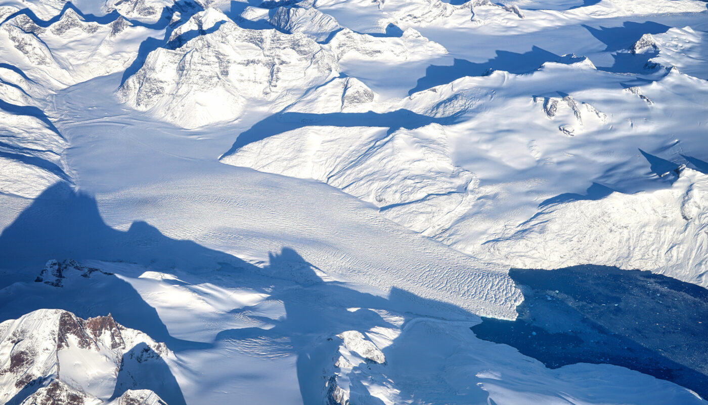
Covering roughly eighty percent of the island, Greenland’s ice reaches more than three kilometers thick in its central regions. Unlike Antarctica, however, Greenland experiences warmer summers, allowing seasonal surface melting across many areas.
During the summer months, meltwater forms streams, rivers, ponds, and brilliant blue lakes on top of the ice. Some of this water drains through deep cracks known as moulins, eventually reaching the base of the ice sheet. This process can reduce friction between the ice and bedrock, allowing glaciers to move more quickly toward the ocean.
Because Greenland responds relatively rapidly to rising temperatures, it has become one of the world’s most closely observed regions for climate research.
Ice Sheets Compared with Glaciers
Many people mistakenly use the terms “ice sheet” and “glacier” interchangeably, but they describe different types of ice formations.
A glacier is a river of ice that flows downhill through valleys or across mountain slopes. Glaciers can be found on every continent except Australia.
An ice sheet, on the other hand, covers an enormous landmass and feeds thousands of glaciers that extend from its edges.
In simple terms, every ice sheet contains glaciers, but not every glacier belongs to an ice sheet.
Ice Shelves: Floating Extensions of Ice Sheets
Another feature commonly associated with polar regions is the ice shelf.
An ice shelf forms where a glacier or ice sheet reaches the ocean and begins floating on seawater while remaining attached to the land.
Although floating ice shelves do not directly increase sea level if they melt, they serve an important purpose. They slow the movement of inland glaciers by acting as natural barriers.
When an ice shelf weakens or breaks apart, glaciers behind it often speed up, increasing the amount of land-based ice entering the ocean.
Why Ice Sheets Are So Important
Regulating Global Sea Level
Perhaps the most widely recognized importance of ice sheets is their influence on sea level.
The Antarctic and Greenland ice sheets contain enormous amounts of frozen freshwater. If substantial portions melt over time, additional water enters the oceans, gradually raising global sea levels.
Even relatively small increases in sea level can contribute to more frequent coastal flooding, shoreline erosion, saltwater intrusion into freshwater supplies, and increased vulnerability during storms.
Reflecting Solar Energy
Ice sheets are highly reflective.
Their bright white surfaces bounce a significant portion of incoming sunlight back into space rather than absorbing it.
This reflective ability helps keep polar regions cooler and contributes to regulating Earth’s overall temperature.
As snow and ice disappear, darker surfaces such as rock and ocean absorb more heat, creating a cycle in which warming leads to additional melting.
Preserving Freshwater
Most of Earth’s accessible water is salty.
Only a small percentage is freshwater, and the majority of that freshwater remains frozen within Antarctica and Greenland.
These ice sheets therefore serve as Earth’s largest natural freshwater reservoirs.
Influencing Ocean Circulation
When freshwater from melting ice enters the oceans, it changes seawater density and salinity.
These changes can influence major ocean currents responsible for distributing heat around the globe.
Scientists continue studying how long-term ice loss could affect global circulation patterns and regional climates.
Recording Earth’s Climate History
Ice sheets act as natural archives.
Each winter’s snowfall traps tiny air bubbles, dust particles, volcanic ash, and other materials from the atmosphere.
As new snow accumulates, these layers become sealed within the ice.
Scientists drill deep ice cores that reveal detailed records of Earth’s climate extending back hundreds of thousands of years.
By analyzing these cores, researchers can reconstruct ancient temperatures, atmospheric greenhouse gas concentrations, volcanic eruptions, wildfire activity, and changes in Earth’s environment long before modern instruments existed.
Wildlife Around Polar Ice Sheets
Although ice sheets themselves appear barren, the surrounding environments support remarkable wildlife.
Antarctica
Animals commonly associated with Antarctica include:
- Emperor penguins
- Adélie penguins
- Weddell seals
- Leopard seals
- Orcas
- Antarctic krill
These species depend on sea ice and the surrounding marine ecosystem for feeding and breeding.
Greenland
Greenland’s Arctic environment supports:
- Polar bears
- Arctic foxes
- Musk oxen
- Snowy owls
- Ringed seals
- Walruses
Changes in ice conditions can alter habitats, migration routes, and food availability for many of these animals.
How Scientists Monitor Ice Sheets
Studying enormous ice sheets requires advanced technology.
Researchers combine multiple methods to understand how these frozen systems behave.
Satellites
Earth-observing satellites continuously measure changes in ice elevation, movement, surface temperature, and overall mass.
GPS Instruments
Sensitive GPS stations detect tiny movements in the ice, allowing scientists to calculate flow speed.
Radar Surveys
Special radar equipment can penetrate thick ice, revealing the hidden landscape beneath.
Ice Core Drilling
Long cylinders of ancient ice provide detailed information about past climates and atmospheric composition.
Research Aircraft
Aircraft equipped with lasers and radar collect highly accurate maps of ice thickness and surface elevation.
Underwater Robots
Autonomous vehicles explore beneath floating ice shelves, measuring water temperature and observing how warm ocean currents interact with the ice.
Challenges Facing Antarctica and Greenland
Both ice sheets naturally gain ice through snowfall and lose ice through melting and iceberg formation.
However, modern observations show that the balance has shifted in many regions.
Scientists have documented:
- Longer melt seasons in Greenland
- Faster-moving outlet glaciers
- Thinning ice shelves around Antarctica
- Increased iceberg calving
- Changes in snowfall distribution
- Warming ocean waters reaching glacier fronts
These changes vary from region to region, making continuous scientific observation essential.
Common Misconceptions About Ice Sheets
Several myths often create confusion.
Myth: Ice sheets never move.
Reality: Ice sheets flow continuously, although the movement is extremely slow.
Myth: Antarctica is perfectly flat.
Reality: Beneath the ice lies a rugged landscape containing mountains, valleys, lakes, and volcanic regions.
Myth: Icebergs and ice sheets are the same thing.
Reality: Icebergs are pieces that break away from glaciers or ice shelves, while ice sheets remain attached to land.
Myth: Only people living near the poles should care about ice sheets.
Reality: Because ice sheets influence sea level, climate, weather, and ocean circulation, changes in Antarctica and Greenland can affect people worldwide.
Looking Toward the Future
The study of Earth’s ice sheets has become one of the most important fields in climate science. International research teams continue improving computer models, expanding satellite observations, and conducting field expeditions to better understand how Antarctica and Greenland may evolve in the coming decades.
Although many uncertainties remain, scientists agree that careful monitoring is essential for improving predictions about sea-level rise, freshwater availability, and future environmental change. Continued research also helps governments, coastal communities, and industries prepare for long-term challenges associated with a changing climate.
Conclusion
Ice sheets are among the most remarkable features of our planet. Formed over countless generations through the gradual accumulation and compression of snow, they have become immense stores of freshwater and powerful regulators of Earth’s climate system. Antarctica’s vast ice sheet dominates the Southern Hemisphere, while Greenland’s northern ice sheet provides critical insights into how polar environments respond to changing conditions.
Far more than frozen landscapes, these colossal masses of ice influence sea levels, reflect sunlight, shape ocean circulation, preserve ancient climate records, and support unique ecosystems. As scientific knowledge continues to grow, understanding Antarctica and Greenland becomes increasingly important for anyone interested in the future of our planet.
Learning about ice sheets is not simply an exploration of remote polar regions—it is an opportunity to better understand the interconnected systems that sustain life on Earth and the importance of protecting them for future generations.