 by
Introduction
Iceland is famous for its dramatic landscapes, where glaciers, volcanoes, mountains, rivers, and waterfalls exist remarkably close to one another. Among these natural features, Vatnajökull stands out as one of the most impressive. Located in southeastern Iceland, it is Europe’s largest ice cap by volume and forms the centrepiece of Vatnajökull National Park. Its enormous frozen surface feeds numerous outlet glaciers that extend outward through valleys and mountain corridors, creating a landscape that resembles a network of frozen rivers.
These outlet glaciers are not stationary blocks of ice. They slowly move under their own weight, carrying rocks, sediment, and enormous quantities of frozen water towards lower elevations. Some descend into valleys, while others approach glacial lakes or spread towards Iceland’s coastal lowlands. Their movements influence the surrounding landscape, supply meltwater to rivers, and provide valuable information about changing environmental conditions.
Vatnajökull’s outlet glaciers also demonstrate the relationship between climate, geology, and water. Their changing shapes reveal how warming temperatures affect ice reserves, while volcanic activity beneath the ice creates additional geological hazards. Understanding this remarkable system helps explain why Vatnajökull is important not only to Iceland but also to glaciological research around the world.
1. Understanding the Vatnajökull Ice Cap
Vatnajökull is a vast ice cap covering a substantial portion of southeastern Iceland. According to Vatnajökull National Park, its area was approximately 7,500 square kilometres in 2023, representing around seven percent of Iceland’s land area. It is still Europe’s largest ice cap by volume and has lost more than 15 percent of its volume during the previous century.
Unlike a single glacier flowing down one mountain valley, an ice cap spreads across a broad elevated region. Ice accumulates over its higher surfaces and gradually moves outward towards lower ground. As it travels, the ice follows the underlying topography, including valleys, depressions, and deep channels.
This outward movement creates individual glacier branches known as outlet glaciers. Each branch drains ice from part of the main ice cap and carries it towards a lower-elevation area.
The result is a complicated system of moving ice streams. Some outlet glaciers are relatively narrow and confined by steep mountain walls, while others spread across wider valleys. Their different shapes and flow patterns make Vatnajökull an important natural laboratory for understanding glacier behaviour.
2. What Are Outlet Glaciers?
An outlet glacier is a section of ice that flows away from a larger ice cap or ice sheet through a natural valley or drainage route. It acts like a frozen river, transporting ice from an accumulation area towards a region where melting becomes greater than snowfall.
The comparison with rivers is useful because both systems move downhill and respond to the shape of the land. However, glaciers move much more slowly than ordinary rivers, and their movement is controlled by ice deformation, gravity, temperature, and conditions beneath the ice.
Outlet glaciers receive ice from the central ice cap and gradually transport it towards their lower ends, known as glacier termini or snouts. At these locations, ice may melt into streams, break into lakes, or interact with other parts of the surrounding environment.
Some outlet glaciers of Vatnajökull also experience sudden periods of accelerated movement called surges. These events make the ice system particularly interesting because individual glaciers can behave differently even when they belong to the same ice cap.
3. How the Frozen Rivers Form and Move
The formation of Vatnajökull’s outlet glaciers begins with snowfall at higher elevations. During cold seasons, snow accumulates on the ice cap. When annual snowfall exceeds the amount lost through melting and other processes, the glacier can maintain or increase its ice reserves.
Over time, newly deposited snow becomes compressed under the weight of additional layers. It gradually changes into firn, an intermediate stage between snow and glacier ice. Continued compression and recrystallisation eventually produce dense glacial ice.
As the ice becomes thicker, gravity causes it to deform and move downhill. This movement occurs through two main processes:
- Internal deformation: Ice crystals change shape and slide past one another under pressure, allowing the glacier to flow.
- Basal sliding: The glacier moves over its underlying surface, sometimes helped by meltwater at the ice-bed interface.
The speed of movement depends on several factors, including ice thickness, surface slope, temperature, and the nature of the material beneath the glacier.
Research presented by Vatnajökull National Park indicates that some of Iceland’s larger glaciers move approximately one metre per day during summer. Their summer surface speeds are typically around twice their winter speeds, although individual glaciers and locations vary.
This movement is what makes an outlet glacier resemble a frozen river. The ice continuously transports material from higher elevations towards the glacier’s lower margins.
4. Major Outlet Glaciers of Vatnajökull
Vatnajökull contains numerous outlet glaciers extending in different directions. Each has distinctive physical characteristics and contributes to the wider glacial landscape.
Breiðamerkurjökull
<AsyncImage query=”Breidamerkurjokull glacier Iceland aerial view Jökulsarlon glacier tongue” aspectRatio=”16:9″ width=”100%”/>
Breiðamerkurjökull is one of the best-known outlet glaciers of Vatnajökull. It flows towards the famous Jökulsárlón glacial lagoon, where large pieces of ice break away from the glacier and float across the water.
The glacier’s retreat has contributed to the development and expansion of the lagoon. Its interaction with the lake provides an excellent example of how a glacier can lose ice through both surface melting and calving.
Breiðamerkurjökull is particularly important to researchers because its changing terminus reveals how lake conditions can influence glacier behaviour.
Skeiðarárjökull
<AsyncImage query=”Skeidararjokull Vatnajokull glacier Iceland aerial landscape” aspectRatio=”16:9″ width=”100%”/>
Skeiðarárjökull extends from the southern part of Vatnajökull towards the broad lowland plains of Skeiðarársandur. It is closely connected to the history of glacial rivers and major outburst floods in the region.
The surrounding landscape contains extensive deposits of sand, gravel, and other material transported by meltwater. These deposits demonstrate the ability of glacial rivers to reshape large areas over time.
Skaftafellsjökull
<AsyncImage query=”Skaftafellsjokull glacier tongue lagoon Vatnajokull Iceland” aspectRatio=”16:9″ width=”100%”/>
Skaftafellsjökull is a prominent outlet glacier in the Skaftafell area of Vatnajökull National Park. Its accessible foreland provides opportunities to observe glacial landforms, changing ice margins, and the development of water-filled depressions.
The retreating glacier has exposed landscapes that were previously covered by ice, allowing scientists and visitors to examine the effects of glacial erosion and deposition.
Svínafellsjökull
<AsyncImage query=”Svinafellsjokull glacier Iceland ice tongue mountains” aspectRatio=”16:9″ width=”100%”/>
Svínafellsjökull is another well-known outlet glacier in southeastern Iceland. It descends through a rugged mountain setting and displays features associated with moving glacier ice, including crevasses and exposed ice surfaces.
Its surrounding landscape is valuable for understanding how glaciers interact with mountain valleys and deposit sediment as their margins change.
Brúarjökull and Dyngjujökull
<AsyncImage query=”Bruarjokull Vatnajokull glacier Iceland aerial” aspectRatio=”16:9″ width=”100%”/>
<AsyncImage query=”Dyngjujokull Vatnajokull outlet glacier Iceland” aspectRatio=”16:9″ width=”100%”/>
Brúarjökull and Dyngjujökull are major outlet glaciers on the northern side of Vatnajökull. They demonstrate that the ice cap’s outward drainage system extends well beyond the famous southern tourist areas.
Brúarjökull is particularly notable for its history of surging behaviour. These northern outlets also contribute to the wider network of glacial rivers that drain the ice cap.
5. The Role of Ice Surges in Glacier Movement
Not every outlet glacier moves at a steady pace. Some glaciers experience a phenomenon known as a surge, during which their movement becomes dramatically faster for a limited period.
A surge can occur when water pressure beneath the glacier increases and allows the ice to slide more rapidly over its bed. During these events, a glacier that normally moves slowly may advance a considerable distance over several months.
Vatnajökull contains several glaciers with a history of surge-type behaviour. According to the national park’s glaciology information, surges can affect large areas of the ice cap and influence the movement of neighbouring ice drainage systems.
These events are important because they demonstrate that glacier movement is controlled by more than air temperature alone. Water beneath the ice, surface slope, bedrock shape, and internal ice conditions all contribute to glacier dynamics.
A surge does not necessarily indicate long-term growth of the entire ice cap. It mainly transfers ice from one part of a glacier towards another, changing the distribution of ice within the system.
6. How Outlet Glaciers Create Rivers and Lakes
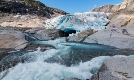
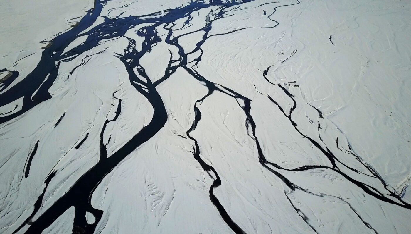
When outlet glaciers reach lower elevations, melting releases water from their snouts. This water collects in channels and develops into glacial rivers that carry sediment away from the ice.
These rivers often have a cloudy appearance because they contain extremely fine rock particles produced by glacial erosion. This distinctive water is sometimes called glacial milk.
The rivers can change their routes as the glacier margin retreats or as new sediment deposits alter the surrounding landscape. Old river channels may become dry, while new waterways develop in different locations.
Glaciers also create lakes. As moving ice erodes deep depressions in the underlying landscape, water can collect in these spaces after the glacier retreats.
Jökulsárlón is one of Iceland’s best-known examples. It occupies a deep basin carved by Breiðamerkurjökull. As the glacier loses ice, pieces break away from its front and float through the lagoon.
Such lakes are not simply scenic features. They can influence the rate of glacier loss because water can transfer heat to the ice and encourage additional calving.
7. The Relationship Between Glaciers and Volcanoes
One of the most remarkable characteristics of Vatnajökull is the volcanic activity hidden beneath and around its ice.
The ice cap covers several volcanic systems, including Grímsvötn, Bárðarbunga, Kverkfjöll, and Öræfajökull. Heat from geothermal activity can melt ice at the glacier bed, creating water beneath the surface.
When volcanic activity releases large amounts of heat, substantial quantities of meltwater may accumulate beneath the ice. If this water escapes suddenly, it can produce a powerful glacial outburst flood known in Icelandic as a jökulhlaup.
These floods can carry enormous volumes of water, sediment, and debris across surrounding plains. They have played a major role in shaping Iceland’s river valleys, sandur plains, and coastal landscapes.
The interaction between fire and ice makes Vatnajökull different from many other glacier systems. Its outlet glaciers are influenced not only by climate but also by geothermal processes and volcanic activity.
8. How Climate Change Is Transforming the Outlet Glaciers
Climate change is one of the most significant forces affecting Vatnajökull. Rising temperatures increase ice loss, alter the balance between snowfall and melting, and influence the shape of glacier margins.
The southern outlet glaciers have experienced substantial thinning and retreat. Many have moved away from their former positions, exposing areas of land that were previously covered by ice.
The retreat of Breiðamerkurjökull illustrates how these changes can transform an entire landscape. Its expanding glacial lagoon demonstrates the close relationship between ice loss, water accumulation, and calving.
The process is not identical for every outlet glacier. Local bedrock shape, valley geometry, elevation, snowfall, and contact with water can influence how quickly individual glaciers change.
Researchers monitor these differences through field measurements, aerial photographs, satellite observations, and ice-thickness surveys.
The national park reports that regular monitoring of glacier termini has been carried out by volunteers from the Iceland Glaciological Society since 1930. These long-term records help scientists understand how individual glacier fronts advance, retreat, or occasionally surge.
9. Why Vatnajökull’s Outlet Glaciers Matter to Iceland
The outlet glaciers are important far beyond their visual appeal. They influence water supplies, river systems, electricity production, ecosystems, and the development of the surrounding landscape.
Meltwater from Vatnajökull contributes to rivers that flow across Iceland. Some of this water is used for hydropower generation, making the ice cap an important part of the country’s natural water resources.
Glacial rivers also transport sediment and help maintain extensive outwash plains. These landscapes provide valuable habitats and reveal the history of earlier floods and glacier movements.
For scientists, the outlet glaciers offer opportunities to study processes that also occur around much larger ice sheets in Greenland and Antarctica. Their relatively accessible margins make it possible to measure changes and compare observations over time.
The glaciers are therefore important both as natural water systems and as indicators of environmental change.
10. Exploring Vatnajökull’s Outlet Glaciers Responsibly
Vatnajökull National Park attracts visitors interested in glacier landscapes, hiking, photography, and geological features. Several outlet glaciers can be viewed from accessible areas, including parts of Skaftafell and the Jökulsárlón region.
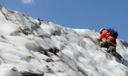
However, visitors should remember that a glacier is a constantly changing natural environment. Its surface may contain deep cracks, unstable ice, hidden cavities, and areas where meltwater flows beneath the surface.
Never walk onto glacier ice without suitable equipment, training, and professional guidance. For activities such as glacier hiking or ice-cave exploration, choose qualified operators who follow appropriate safety procedures.
Weather conditions can change rapidly, and glacier access may be restricted because of ice movement, flooding, or other hazards.
Visitors can also help protect these environments by following marked paths, avoiding disturbance to vegetation, respecting wildlife, and following national park instructions.
Responsible tourism allows people to experience the frozen river system while reducing risks to themselves and the surrounding landscape.
Conclusion
Vatnajökull’s outlet glaciers form one of the most fascinating glacial systems in the world. Flowing outward from Europe’s largest ice cap by volume, these frozen rivers transport ice through valleys, shape mountain landscapes, feed glacial rivers, and create lakes that continue to evolve as the climate changes.
Glaciers such as Breiðamerkurjökull, Skeiðarárjökull, Skaftafellsjökull, and Svínafellsjökull demonstrate the variety of forms and behaviours found around the ice cap. Their movements are influenced by gravity, temperature, snowfall, water beneath the ice, and even volcanic activity.
Today, retreating glacier fronts and expanding glacial lakes provide visible evidence of environmental change. Continued monitoring is essential for understanding how the ice cap will evolve and how its changing water systems may affect Iceland.
Ultimately, Vatnajökull is much more than a frozen landscape. It is a living network of moving ice, flowing water, geological activity, and natural processes that continue to shape the island.