 by
by For centuries, glaciers were among the most difficult natural environments for scientists to study. Their remote locations, unstable surfaces, freezing temperatures, and constantly shifting terrain made fieldwork dangerous, expensive, and slow. Researchers often had to rely on satellite imagery, aerial photography from helicopters, or physically traveling across hazardous ice fields to collect data.
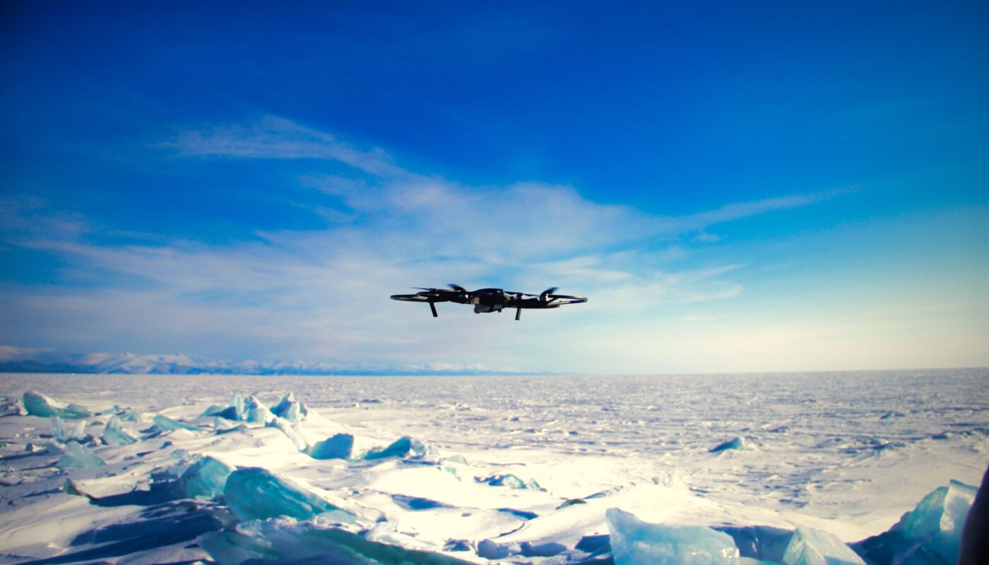
Today, that reality is changing rapidly because of drone technology.
Unmanned aerial vehicles—commonly known as drones—are transforming glacier research in ways that were almost unimaginable just two decades ago. Lightweight, relatively affordable, and capable of flying over dangerous terrain, drones now allow scientists to monitor glaciers with unprecedented precision and frequency.
From mapping ice loss to tracking meltwater channels and measuring glacier movement, drones are becoming one of the most important tools in modern cryosphere science. Their impact extends beyond convenience; they are fundamentally changing how researchers understand climate change and the future of Earth’s frozen regions.
Why Glaciers Are Difficult to Study
Glaciers are dynamic environments. Although they may appear stable from a distance, glaciers are constantly moving, melting, cracking, and reshaping themselves.
Researchers face several major challenges when studying them:
Remote Locations
Many glaciers are located in:
- Polar regions
- High mountain ranges
- Isolated wilderness areas
Reaching these sites often requires helicopters, long expeditions, or specialized climbing equipment.
Dangerous Terrain
Glaciers contain hidden hazards such as:
- Deep crevasses
- Unstable ice walls
- Avalanches
- Sudden ice collapses
Even experienced researchers face significant risks during fieldwork.
Rapid Environmental Change
As temperatures rise, glaciers are changing faster than ever before. Scientists need frequent and accurate observations, but traditional surveying methods are often too slow or expensive to provide continuous monitoring.
This is where drones have become revolutionary.
What Makes Drones Useful for Glacier Research?
Drones bridge the gap between satellite imagery and on-the-ground fieldwork.
Satellites provide large-scale coverage but often lack fine detail or flexibility. Ground surveys provide accuracy but are time-consuming and risky.
Drones offer the advantages of both:
- High-resolution imagery
- Flexible flight paths
- Rapid deployment
- Lower operational costs
- Access to dangerous areas without risking human lives
This combination allows scientists to collect detailed data far more efficiently than before.
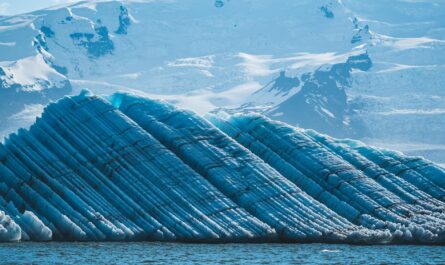
Mapping Glacier Surfaces in Extraordinary Detail
One of the biggest contributions of drones is high-resolution surface mapping.
Using advanced cameras and sensors, drones can capture thousands of overlapping images during a single flight. Specialized software then combines these images into:
- Detailed 3D models
- Digital elevation maps
- Surface texture reconstructions
These maps reveal changes that may be invisible to satellites.
Researchers can now measure:
- Ice thickness changes
- Surface cracks
- Snow accumulation patterns
- Meltwater channels
- Glacier retreat distances
In some cases, drones can detect changes measured in centimeters.
Tracking Glacier Movement
Although glaciers move slowly, their motion is critically important to understanding climate systems.
Traditionally, tracking glacier movement required:
- GPS equipment placed directly on the ice
- Repeated field visits
- Manual measurements
Drones simplify this process dramatically.
By comparing repeated aerial surveys over time, researchers can calculate:
- Flow speed
- Direction of movement
- Structural changes in the glacier
This allows scientists to observe how warming temperatures affect glacier behavior in near real time.
Studying Dangerous Areas Safely
Some glacier regions are simply too dangerous for people to access regularly.
Examples include:
- Ice cliffs
- Meltwater caves
- Calving fronts where glaciers break into the ocean
- Thin or unstable ice zones
Drones can safely enter or fly above these hazardous environments while transmitting live data back to researchers.
This has dramatically improved both:
- Research safety
- Data collection opportunities
Instead of risking human lives, scientists can now observe dangerous ice features remotely.
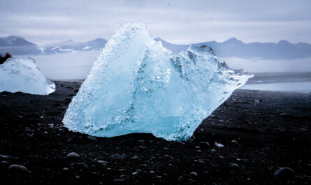
Measuring Glacier Melt More Accurately
One of the most urgent areas of glacier science is measuring ice loss.
Globally, glaciers are receding due to rising temperatures. Understanding how quickly this is happening is essential for predicting:
- Sea-level rise
- Freshwater availability
- Climate system changes
Drones help by providing:
- Frequent repeat surveys
- Extremely detailed elevation measurements
- Accurate comparisons over time
Because drones can fly low over glaciers, they often produce far more detailed results than satellites alone.
Thermal Imaging and Hidden Meltwater
Modern research drones often carry thermal cameras that detect temperature differences across glacier surfaces.
This allows scientists to identify:
- Hidden meltwater flows
- Warm zones within ice
- Areas vulnerable to collapse
- Subsurface drainage systems
Thermal imaging is especially useful because many glacier processes occur beneath the surface and cannot be seen with normal photography.
By understanding how meltwater moves through glaciers, scientists gain better insight into how glaciers accelerate and destabilize.
Drones and Climate Change Research
Glaciers are among the clearest indicators of climate change. Their retreat reflects rising global temperatures and shifting precipitation patterns.
Because drones allow for more precise glacier monitoring, they are becoming central to climate research.
Scientists use drone data to:
- Improve climate models
- Predict future glacier behavior
- Measure annual ice loss rates
- Understand regional water supply changes
This information helps governments and researchers prepare for long-term environmental impacts.
Monitoring Icebergs and Calving Events
In polar regions, many glaciers terminate in the ocean. These are known as tidewater glaciers.
When large pieces of ice break away from these glaciers, the process is called calving.
Calving events can be:
- Dangerous
- Unpredictable
- Difficult to observe closely
Drones allow researchers to safely monitor these events from the air.
This helps scientists study:
- Iceberg formation
- Glacier instability
- Ocean-glacier interactions
The resulting data is essential for understanding how polar ice contributes to sea-level rise.
Creating Time-Lapse Records of Glacier Change
Repeated drone flights allow scientists to create highly detailed time-lapse studies.
By flying identical routes over weeks, months, or years, researchers can visualize:
- Glacier retreat
- Snowline shifts
- Ice collapse events
- Seasonal changes
These visual records are valuable not only scientifically but also educationally. They provide powerful evidence of environmental change that is easy for the public to understand.
Lower Costs Compared to Traditional Methods
Before drones became widely available, glacier surveys often required:
- Aircraft charters
- Helicopters
- Large research teams
- Expensive equipment
Drones reduce many of these costs significantly.
Small research teams can now:
- Deploy rapidly
- Collect large amounts of data
- Repeat surveys frequently
This has made glacier research more accessible to universities and smaller scientific organizations.
Challenges of Using Drones in Glacier Environments
Despite their advantages, drones are not perfect.
Cold Temperatures
Battery performance drops significantly in freezing conditions, reducing flight time.
Strong Winds
Fjord regions, mountain glaciers, and polar environments often experience unpredictable winds that make drone flights difficult.
Limited Range
Most drones can only travel a certain distance before needing to return for battery replacement.
Harsh Conditions
Snow, ice, and moisture can interfere with equipment and sensors.
Researchers must carefully plan flights to avoid losing drones in dangerous environments.
Artificial Intelligence and the Future of Glacier Drones
The future of glacier research will likely involve increasing integration between drones and artificial intelligence.
AI systems can help drones:
- Automatically identify cracks and crevasses
- Analyze surface changes
- Detect patterns humans might miss
- Process massive amounts of imagery quickly
Autonomous drones may eventually conduct regular glacier surveys with minimal human involvement.
Drones Beyond Science
Drone imagery is also changing how the public sees glaciers.
High-quality aerial footage allows people worldwide to witness:
- Glacier retreat
- Ice cave collapses
- Polar landscapes
- Melting ice sheets
This visual storytelling plays an important role in environmental awareness and climate education.
In many cases, drone footage makes climate change feel immediate and real in a way that graphs and statistics cannot.
Ethical and Environmental Considerations
As drone usage grows, researchers must also consider ethical impacts.
Important concerns include:
- Disturbing wildlife
- Noise pollution in fragile ecosystems
- Respecting protected areas and indigenous territories
Responsible drone operation is essential to ensure research does not unintentionally damage the environments being studied.
The Future of Glacier Research
Drone technology is advancing rapidly.
Future glacier research may include:
- Swarms of coordinated drones
- Longer-lasting batteries
- Real-time satellite-linked data transmission
- Autonomous polar research systems
As technology improves, scientists will gain even more precise understanding of how glaciers behave and how quickly they are changing.
Final Thoughts
Drones are transforming glacier research by making it safer, faster, more affordable, and far more detailed than ever before.
What once required dangerous expeditions and costly aircraft can now often be accomplished with compact aerial systems capable of collecting incredibly precise data. Researchers can monitor glacier retreat, study ice movement, measure melting patterns, and observe dangerous environments without putting human lives at unnecessary risk.
More importantly, drones are helping scientists better understand one of the defining environmental challenges of our time: the rapid transformation of Earth’s frozen landscapes.
As glaciers continue to shrink under a warming climate, the information gathered by drones will become increasingly important—not only for scientific discovery, but also for understanding the future of water resources, sea levels, ecosystems, and life in a changing world.