 by
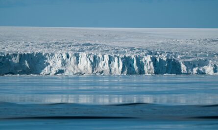
by Glaciers are among the most fascinating and important natural features on Earth. These massive bodies of ice store vast amounts of freshwater and play a critical role in regulating global sea levels and climate systems. Yet, despite their visible grandeur, one of the most important aspects of glaciers lies hidden beneath the surface: their thickness.
Understanding how thick a glacier is helps scientists answer key questions about climate change, water resources, and future environmental risks. But measuring glacier thickness is not as simple as placing a ruler on the ice. In fact, it requires a combination of advanced technology, fieldwork, and physics.
So how do scientists actually measure glacier thickness? The answer involves several innovative methods, each suited to different conditions and challenges.
Why Glacier Thickness Matters
Before exploring the techniques, it’s important to understand why glacier thickness is such a crucial measurement.
Thickness determines:
- How much water a glacier holds
- How quickly it might melt
- How it flows and moves
- Its contribution to sea-level rise
Thickness also helps scientists calculate the total volume of ice in a glacier, which is essential for predicting long-term environmental changes.
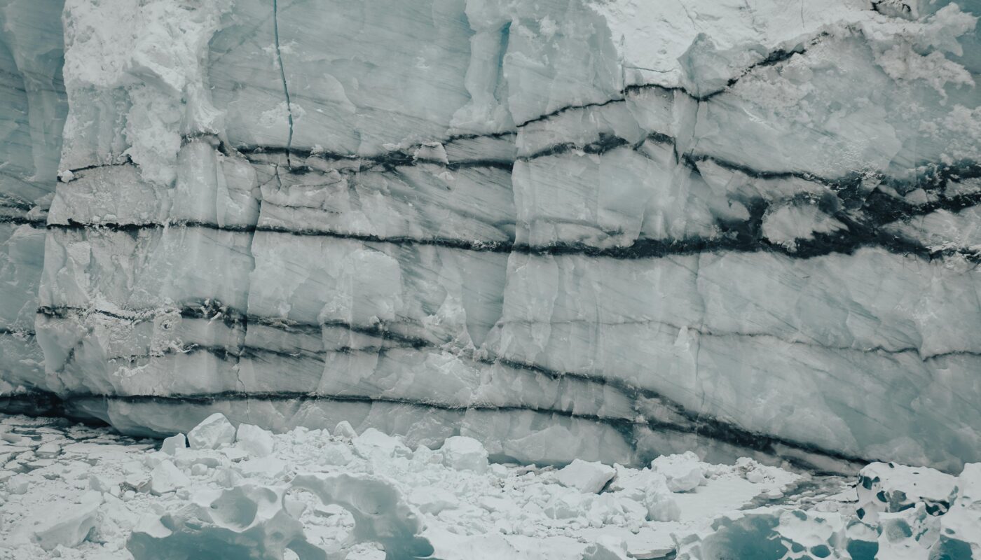
The Challenge of Measuring Ice Depth
Unlike lakes or rivers, glaciers are not transparent. Their surfaces may look smooth, but underneath lies a complex structure of compressed snow, ice layers, air pockets, and sometimes even water channels.
Additionally:
- Glaciers can be hundreds of meters thick
- Their surfaces are often uneven and dangerous
- Many are located in remote or harsh environments
Because of these challenges, scientists rely on indirect measurement techniques rather than simple physical tools.
Ground-Penetrating Radar (GPR): The Most Common Method
One of the primary tools used to measure glacier thickness is Ground-penetrating radar.
How It Works
Ground-penetrating radar sends radio waves into the glacier. These waves travel through the ice until they hit a boundary—usually the bedrock beneath the glacier. When they hit this boundary, they bounce back to the surface.
By measuring how long it takes for the signal to return, scientists can calculate the depth of the ice.
Why It’s Effective
- Works well in thick ice
- Provides continuous measurements along a مسیر (path)
- Can be used on foot, snowmobiles, or aircraft
Limitations
- Signal quality can be affected by water within the ice
- Rough terrain can make data interpretation complex
Despite these challenges, GPR remains one of the most widely used and reliable methods.
Seismic Surveys: Listening to the Ice
Another powerful technique involves seismic waves, similar to those used in earthquake studies.
How It Works
Scientists create small vibrations on the glacier surface using controlled energy sources. These vibrations travel through the ice and reflect off the bedrock below.
Sensors placed on the surface detect the returning waves.
By analyzing the speed and timing of these waves, scientists can estimate glacier thickness.
Advantages
- Highly accurate in difficult conditions
- Useful for very thick or complex glaciers
Drawbacks
- Requires specialized equipment
- More time-consuming than radar methods
Ice Drilling: Direct Measurement
While most methods are indirect, drilling provides a direct way to measure glacier thickness.
How It Works
Scientists drill a hole from the surface all the way down to the base of the glacier. The depth of the hole gives an exact measurement of thickness.
Benefits
- Provides highly accurate data
- Allows scientists to collect ice samples for climate studies
Challenges
- Extremely labor-intensive
- Expensive and time-consuming
- Not practical for large-scale surveys
Because of these limitations, drilling is usually used for research at specific sites rather than broad mapping.
Satellite Technology: Measuring from Space
Modern science increasingly relies on satellites to study glaciers.
Key Concept: Remote sensing
Satellites cannot directly see through ice, but they can measure surface elevation and changes over time.
How It Helps Estimate Thickness
By combining:
- Surface elevation data
- Models of ice density
- Information about glacier flow
Scientists can estimate how thick the glacier must be.
Advantages
- Covers large and remote areas
- Allows continuous monitoring over time
Limitations
- Less precise than ground-based methods
- Requires complex modeling
Ice-Penetrating Radar from Aircraft
A variation of ground-penetrating radar involves airborne systems.
How It Works
Aircraft equipped with radar instruments fly over glaciers, sending signals downward into the ice.
Why It’s Important
- Covers vast areas quickly
- Ideal for polar regions like Antarctica and Greenland
- Provides large-scale thickness maps
Challenges
- Expensive to operate
- Data interpretation can be complex
Mathematical Modeling: Filling in the Gaps
Even with advanced tools, it’s not always possible to measure every part of a glacier directly.
This is where modeling comes in.
How It Works
Scientists use:
- Known thickness measurements
- Surface slope and shape
- Ice flow dynamics
to estimate thickness in areas where direct data is unavailable.
Why It Matters
Modeling allows scientists to:
- Create complete maps of glacier thickness
- Predict how glaciers will change over time
Combining Methods for Better Accuracy
No single method is perfect. That’s why scientists often combine multiple techniques.
For example:
- Radar data for general thickness
- Drilling for calibration
- Satellite data for large-scale trends
By integrating these approaches, researchers can achieve more accurate and comprehensive results.
Real-World Applications
Measuring glacier thickness is not just an academic exercise—it has real-world implications.
Predicting Sea-Level Rise
Thicker glaciers contain more ice, which means more potential contribution to rising sea levels if they melt.
Water Resource Management
In some regions, glaciers act as natural reservoirs. Knowing their thickness helps predict future water availability.
Natural Hazard Assessment
Thickness data can help identify risks such as:
- Glacier collapse
- Flooding from meltwater
- Instability in surrounding terrain
Technological Advances Shaping the Future
The field of glacier measurement is evolving rapidly.
Emerging Innovations
- Drones equipped with radar systems
- Improved satellite resolution
- AI-assisted data analysis
These advancements are making it easier, faster, and more accurate to measure glacier thickness.
Challenges Scientists Still Face
Despite progress, several challenges remain:
- Harsh and remote environments
- Limited access to certain regions
- Changing ice conditions due to climate change
- High costs of equipment and fieldwork
These factors make glacier research both demanding and essential.
A Dynamic Measurement
It’s important to remember that glacier thickness is not static.
Glaciers are constantly:
- Flowing
- Melting
- Accumulating new snow
This means thickness must be measured repeatedly over time to understand trends and changes.
Final Thoughts
Measuring glacier thickness is a complex task that blends physics, engineering, and environmental science. From radar waves traveling through ice to satellites orbiting high above Earth, scientists use a wide range of tools to uncover what lies beneath the surface.
Each method has its strengths and limitations, but together they provide a detailed picture of glacier structure and behavior.
As climate change continues to reshape our planet, understanding glaciers—and how thick they are—has never been more important. These measurements help scientists predict the future, manage resources, and prepare for the environmental challenges ahead.
In the end, what may seem like a simple question—“How thick is a glacier?”—reveals a sophisticated and evolving field of study that connects directly to the health of our planet.