 by
by Across some of the most remote mountain ranges and polar regions on Earth, vast rivers of ice are quietly shrinking. Glaciers—once thought of as permanent features of the landscape—are now changing at a pace that can be observed within a single human lifetime. While scientific measurements record this shift in numerical terms, one of the most powerful ways to truly understand it is through before-and-after photography.
These paired images, captured from the same viewpoint across years or even decades, reveal a transformation that statistics alone cannot communicate. Ice-filled valleys turn into exposed rock, rivers shift course, and entire landscapes take on a different identity. The visual contrast is often striking enough to make the effects of climate change immediately understandable.
Why Visual Records of Glaciers Matter
Glaciers respond directly to long-term climate conditions. When temperatures rise over extended periods, ice loss accelerates. While researchers track these changes using satellites, field surveys, and ice mass measurements, visual documentation plays a different but equally important role: it makes change visible in a way that is intuitive and emotional.
Scientific data has confirmed that many mountain glaciers around the world are shrinking steadily due to warming conditions. However, numbers alone do not always convey the scale of transformation occurring in remote regions.
Photography bridges that gap by turning abstract trends into something the human eye can easily recognize.
The Method Behind Repeat Glacier Photography
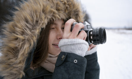
The technique used to create before-and-after glacier images is known as repeat photography. It involves returning to a previously photographed location and recreating the shot as precisely as possible.
To achieve accurate comparisons, photographers aim to match:
- Exact camera position and angle
- Focal length and framing
- Time of year to control seasonal snow differences
- Lighting conditions when feasible
Even small differences in perspective can affect how change is perceived, so careful alignment is essential.
This method has been used for over a century to study environmental change, especially in mountainous and polar regions where glaciers are prominent landscape features.
What Glacier Comparisons Typically Show
When historical and modern images are placed side by side, several consistent patterns of change often appear.
Retreating Ice Boundaries
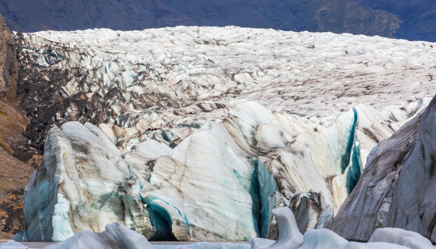
One of the most noticeable differences is the position of the glacier’s front edge. In older images, ice may extend far into valleys, while in recent photos, it has often retreated significantly uphill.
Loss of Ice Volume
Glaciers that once appeared thick and expansive can look dramatically reduced, with thinner ice coverage or fragmented sections.
Newly Exposed Terrain
As ice disappears, bare rock and sediment are revealed. Over time, these areas may begin to support vegetation, marking a shift in ecosystem development.
Formation of Lakes
Melting glaciers frequently leave behind depressions that fill with water. These new lakes often appear bright blue or green, contrasting sharply with the historical ice-covered scene.
Examples from Key Regions
Mountain Glaciers in Alaska
In parts of Alaska, repeat photography has documented some of the most dramatic ice loss on record. Images taken in the early 20th century often show valleys filled with thick ice. Modern recreations reveal that many of these glaciers have significantly retreated or fragmented.
European Alpine Regions
In the European Alps, historical photographs show glaciers extending much farther down mountain slopes than they do today. In many locations, ice that once dominated the landscape has now been replaced by rock, soil, or sparse vegetation.
Arctic Ice Systems
In northern polar regions, repeat photography highlights even more rapid transformation. Some glacier fronts visible in older expedition photographs have disappeared entirely in modern images, replaced by open water or newly formed land surfaces.
How Photographers Recreate Historical Views
Recreating glacier images requires more than simply revisiting a location. It involves careful research and often physically demanding fieldwork.
Step 1: Locating Historical References
Photographers begin by studying archives, expedition records, and early scientific surveys to identify original viewpoints.
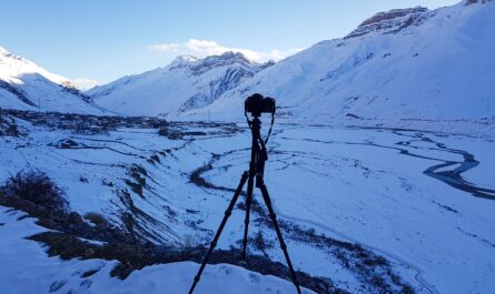
Step 2: Field Positioning
Once a site is identified, the challenge is to physically reach the same vantage point, which may involve hiking, climbing, or navigating remote terrain.
Step 3: Matching Composition
The modern image must closely replicate the original framing, including horizon lines, mountain alignment, and focal distance.
Step 4: Timing the Shot
Seasonal conditions are matched as closely as possible to ensure that snow cover or vegetation does not distort the comparison.
Why These Images Have Strong Impact
Before-and-after glacier photography is powerful because it communicates change instantly. Unlike graphs or written reports, visual comparisons require no interpretation.
Instant Understanding
A viewer can immediately see the difference between past and present landscapes without needing scientific background knowledge.
Emotional Response
Seeing a once-ice-covered valley transformed into rock or water often creates a strong emotional reaction, especially for those familiar with the original landscape.
Long-Term Perspective
These images compress decades of environmental change into a single frame, helping people grasp the slow but continuous nature of glacier retreat.
The Science Behind Glacier Shrinkage
Glaciers grow and shrink naturally over time, but current trends are strongly influenced by rising global temperatures. When melting exceeds snowfall accumulation over long periods, glaciers begin to lose mass.
Key drivers include:
- Increasing air temperatures in mountain regions
- Reduced snow accumulation during winter seasons
- Longer and warmer summer melting periods
- Changes in atmospheric and oceanic circulation patterns
Scientific monitoring confirms that many glaciers are losing ice year after year, contributing to broader environmental shifts.
Landscape Transformation After Ice Loss
When glaciers retreat, they do not simply disappear—they reshape the environment.
New Ecosystems
Exposed ground gradually becomes colonized by plants, beginning a slow process of ecological succession.
Changing Water Systems
Glaciers act as natural reservoirs. As they shrink, the timing and volume of downstream water flow can change significantly.
Geological Adjustments
Without the weight of ice, slopes may become unstable, increasing erosion or rock movement in some regions.
The Role of Photography in Climate Awareness
Repeat glacier photography has become an important tool for communication beyond scientific communities. It is widely used in education, environmental reporting, and public awareness campaigns.
Its effectiveness comes from its simplicity: it shows rather than explains.
This visual clarity helps people understand environmental change in a way that data alone often cannot achieve.
Limitations of the Method
While powerful, before-and-after photography is not without challenges:
- Historical images may lack precise location data
- Natural landscape changes can complicate exact replication
- Differences in weather or season can affect visual comparison
- Some viewpoints may no longer be physically accessible
Despite these limitations, it remains one of the most compelling ways to document environmental change over time.
The Human Perspective on Glacier Loss
Photographers who return to glacier sites after many years often describe a sense of disorientation or loss. Familiar landscapes appear altered beyond recognition.
Where massive ice walls once stood, there may now be open valleys or lakes. This transformation is not just physical—it also represents a shift in how people relate to the natural world.
These emotional responses are part of what gives the images their lasting impact.
Conclusion
Before-and-after photography offers a unique window into the transformation of Earth’s glaciers. By placing past and present images side by side, it reveals changes that might otherwise go unnoticed in everyday life.
As glaciers continue to retreat across the globe, these visual records serve as both documentation and testimony. They preserve evidence of landscapes in transition and help communicate the scale of environmental change in a way that is immediate and universally understandable.
Ultimately, these photographs remind us that even the most seemingly permanent parts of the planet are evolving—and that these changes are happening within our own lifetime.