by
by When people look at a deep valley surrounded by steep mountains or sail through a narrow fjord bordered by towering cliffs, it can be difficult to imagine how such enormous landscapes were created. Rivers, wind, earthquakes, volcanoes, and erosion all play important roles in shaping Earth. However, in many parts of the world, one of the most powerful landscape architects has been ice.
Glaciers may appear to move slowly, but over thousands or even millions of years, they can transform entire regions. A glacier can grind away solid rock, deepen existing valleys, carry huge amounts of sediment, reshape mountain slopes, and leave behind distinctive landforms long after the ice itself has disappeared.
Some of the world’s most spectacular landscapes—including the Norwegian fjords, alpine valleys, glacial lakes, sharp mountain peaks, and broad U-shaped valleys—owe much of their appearance to the movement of ancient or modern glaciers.
Glaciers do not simply sit on top of the land. They interact with it continuously. As ice accumulates and begins to flow downhill under its own weight, it becomes a slow but powerful force of erosion and transportation.
To understand how glaciers shape valleys, fjords, and mountains, it is helpful to think of them as massive natural tools. They scrape, pluck, polish, crush, transport, and deposit material. Over long periods, these processes can completely change the appearance of a landscape.
What Is a Glacier?
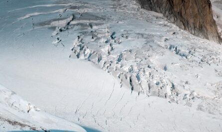
A glacier is a large mass of ice that forms when more snow accumulates over time than melts away.
As layers of snow build up year after year, the weight of new snow compresses the older layers beneath it. Gradually, the snow becomes denser and transforms into solid glacial ice.
When enough ice accumulates, gravity causes it to move.
This movement is one of the most important features of a glacier.
Although glaciers may appear motionless when viewed from a distance, they are actually flowing slowly. Some glaciers move only a few centimeters each day, while others can move much faster under the right conditions.
The speed depends on factors such as:
- The slope of the land
- The thickness of the ice
- The amount of meltwater beneath the glacier
- Temperature conditions
- The shape of the valley
- The type of rock beneath the ice
As glaciers move, they interact with the land underneath and around them.
This is where their landscape-shaping power begins.
Glaciers as Natural Erosion Machines
Glaciers reshape landscapes mainly through two important processes:
Abrasion
Abrasion occurs when rocks, sand, and other debris trapped within the ice scrape against the bedrock beneath the glacier.
Imagine sandpaper moving repeatedly across a wooden surface.
A glacier can work in a similar way, although on an enormous scale.
The ice carries pieces of rock that grind and scratch the land as the glacier moves forward.
Over thousands of years, this process can smooth solid rock and deepen valleys.
Abrasion can leave visible marks known as glacial striations. These are long scratches or grooves in exposed rock that reveal the direction in which the glacier once moved.
Plucking
Plucking happens when glacier ice freezes onto pieces of fractured or weakened bedrock.
As the glacier continues moving, it can pull pieces of rock away from the landscape.
These rocks then become trapped in the glacier and may continue to help erode the surface beneath it.
Plucking can make valleys deeper and mountain slopes steeper.
Together, abrasion and plucking allow glaciers to remove enormous quantities of rock.
Over long periods, these processes can transform narrow river valleys into broad glacial landscapes.
How Glaciers Create U-Shaped Valleys
One of the clearest signs of past glacial activity is a U-shaped valley.
Before a glacier enters a mountain valley, the valley may have been shaped mainly by a river.
Rivers typically create valleys with a V-shaped profile.
This happens because running water cuts downward into the landscape while erosion also affects the valley sides.
When a glacier moves through the same valley, the situation changes.
A glacier is much wider than a river.
Instead of cutting only into the valley floor, the ice pushes against and erodes both the bottom and sides.
Over time, the valley becomes:
- Wider
- Deeper
- Flatter at the bottom
- Steeper along the sides
The result is a broad valley with a rounded or U-shaped cross-section.
This transformation can be dramatic.
A relatively narrow river valley can eventually become a huge glacial corridor surrounded by steep mountain walls.
Even after the glacier disappears, the U-shaped valley remains as evidence of the ice that once occupied it.
Many famous mountain valleys in Norway, Switzerland, Canada, New Zealand, and other glaciated regions were shaped or strongly modified by ancient glaciers.
How Glaciers Create Hanging Valleys
Glaciers of different sizes do not always erode landscapes equally.
Imagine a large main glacier flowing through a major valley while smaller glaciers flow into it from nearby mountain valleys.
The larger glacier usually has greater erosive power.
It may carve its valley much deeper than the smaller tributary glaciers.
When the glaciers eventually retreat, the smaller valley may remain high above the deeper main valley.
This feature is called a hanging valley.
In many cases, a stream flows from the hanging valley and drops dramatically into the main valley.
This is one reason glacial regions often have spectacular waterfalls.
The famous waterfalls of many fjord and mountain landscapes are closely connected to this difference in glacial erosion.
What was once a network of connected ice flows can become a landscape of elevated valleys and cascading water.
From Glacial Valleys to Fjords
Fjords are among the most dramatic examples of glacial landscape formation.
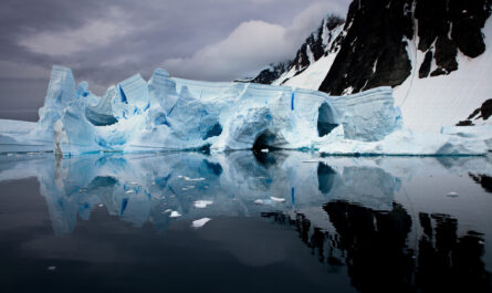
A fjord is essentially a deep valley carved by glaciers that later became flooded by the sea.
The process usually begins with a glacier occupying a coastal valley.
As the glacier moves, it erodes the valley floor and sides.
Because glaciers can carve deeply into the landscape, some valleys are cut far below present-day sea level.
Eventually, the climate changes.
The glacier retreats or melts away.
If the valley is connected to the ocean, seawater can flow into the deep glacial trough.
The result is a fjord.
This is why fjords often have:
- Deep water
- Narrow entrances
- Steep mountain walls
- Dramatic cliffs
- Waterfalls descending from high valleys
The Norwegian fjords are among the world’s best-known examples, but fjords are also found in places such as New Zealand, Greenland, Iceland, Canada, Chile, and Alaska.
The remarkable depth of some fjords is directly connected to the ability of glaciers to erode the land beneath them.
In some cases, glaciers carved sections of valleys much deeper than the surrounding landscape.
After the ice disappeared and seawater entered, these deep basins became part of the modern fjord system.
Why Are Fjords Often So Deep?
The enormous depth of some fjords surprises many visitors.
The reason is connected to the behavior of glaciers.
The thickest ice can exert significant pressure on the land beneath it.
In certain parts of a valley, especially where ice was thick and movement was concentrated, erosion could be particularly strong.
The glacier gradually deepened the valley.
However, erosion was not always equal across the entire landscape.
In some locations, harder rock resisted erosion more effectively than softer or fractured rock.
This created an uneven valley floor.
After the glacier retreated and the ocean entered, the result was a deep underwater landscape containing basins, ridges, and thresholds.
This is why a fjord is not simply a mountain valley filled with seawater.
Below the surface, fjords can contain complex geological features created by ancient ice.
How Glaciers Shape Mountain Peaks
Glaciers do not only carve valleys.
They also transform mountains.
When glaciers develop on several sides of a mountain, they can erode the slopes from different directions.
Over time, the mountain may become sharper and more dramatic.
Several distinctive landforms can develop.
Cirques
A cirque is a bowl-shaped hollow that forms high in the mountains.
It often develops where snow and ice repeatedly accumulate.
The glacier erodes the surrounding rock and creates a steep, amphitheater-like basin.
After the glacier melts, a small lake may form inside the cirque.
These lakes are often called tarns.
Arêtes
An arête is a narrow ridge formed between two glacial valleys or cirques.
As glaciers erode the rock on both sides, the remaining ridge becomes increasingly sharp.
Some famous mountain ridges have been shaped through this process.
Horns
When several glaciers erode a mountain from different sides, they can create a sharp, pyramid-like peak known as a horn.
The Matterhorn is one of the world’s most famous examples of a mountain shaped by glacial erosion.
These landforms show how glaciers can make mountains appear more dramatic rather than simply wearing them down.
Glacial erosion removes material from multiple directions and can leave behind sharp ridges and pointed peaks.
Glaciers Can Also Transport Huge Amounts of Rock
Glaciers do more than destroy and reshape.
They also carry material.
As ice moves across the landscape, it transports:
- Boulders
- Gravel
- Sand
- Soil
- Broken pieces of bedrock
Some material is carried on the surface of the glacier.
Other debris becomes trapped inside the ice or moves beneath it.
When the glacier melts, this material is left behind.
The deposits can create entirely new landforms.
Moraines: Landscapes Built by Glaciers
One of the most recognizable glacial deposits is a moraine.
A moraine is made from rock and sediment transported and deposited by a glacier.
There are several types.
Lateral Moraines
These form along the sides of a glacier.
Medial Moraines
These can develop when two glaciers join together and the debris from their edges becomes concentrated in the middle of the new glacier.
Terminal Moraines
These form near the furthest point reached by a glacier.
When the glacier remains in one position for a period, it can deposit large amounts of material.
The terminal moraine can remain long after the glacier retreats.
Moraines provide important evidence of where glaciers once existed and how far they extended.
Scientists can study these features to reconstruct past climates and glacier movements.
How Glaciers Create Lakes
Glaciers are also closely connected to the formation of many lakes.
As a glacier erodes a valley, it may create depressions in the landscape.
After the ice retreats, these depressions can fill with water.
Lakes may also form when moraines act as natural barriers.
Water collects behind the deposited material, creating a glacial lake.
Glacial lakes can vary enormously in size.
Some are small mountain tarns.
Others are large lakes filling entire valleys.
The clear blue or green colors often associated with glacial lakes can be influenced by fine rock particles carried by meltwater.
These tiny particles are sometimes called glacial flour or rock flour.
They can remain suspended in the water and affect how light is reflected.
Glaciers and the Formation of Waterfalls
Waterfalls are another common feature of glaciated landscapes.
As mentioned earlier, hanging valleys can create dramatic drops where streams enter deeper valleys.
Glacial erosion can also leave uneven surfaces.
After the ice disappears, rivers and streams begin flowing through the newly exposed landscape.
Where the water encounters a sudden change in elevation, waterfalls may form.
This is one reason fjord regions are often famous for spectacular waterfalls.
The waterfalls are not always created directly by the glacier alone.
Instead, they are often the result of what happens after the glacier reshapes the landscape and meltwater or rainfall begins flowing through the altered terrain.
In this way, glaciers can continue influencing landscapes even after they have disappeared.
How Glaciers Continue to Shape the Land Today
Glacial landscapes are not frozen in time.
Modern glaciers continue to move and interact with their surroundings.
They continue to:
- Erode rock
- Transport sediment
- Produce meltwater
- Alter river systems
- Create lakes
- Deposit debris
At the same time, many glaciers around the world are retreating.
As glaciers shrink, they expose landscapes that may have been covered by ice for centuries or thousands of years.
New lakes can appear.
Unstable slopes may become exposed.
Rivers can change their paths.
Fresh sediment may enter valleys and coastal waters.
Therefore, glacier retreat does not simply mean that ice disappears.
It can trigger an entirely new stage of landscape development.
A valley that was once dominated by ice may gradually become occupied by vegetation, rivers, lakes, and new ecosystems.
Mountains and Glaciers: A Continuous Relationship
Glaciers and mountains influence each other.
Mountains provide the high, cold environments where snow can accumulate.
Glaciers then reshape those mountains.
This creates a long-term cycle.
High mountains encourage ice formation.
The moving ice erodes valleys and slopes.
The altered landscape changes how future glaciers flow.
Over thousands of years, the relationship between rock, ice, water, and climate produces increasingly complex terrain.
The spectacular scenery seen in many mountain regions is therefore the result of several natural forces working together.
Glaciers may be among the slowest landscape-changing forces, but their long-term effects can be enormous.
Why Understanding Glacial Landscapes Matters
Learning how glaciers shape the land helps us see familiar scenery differently.
A valley is no longer simply a valley.
It may be the path of an ancient river of ice.
A waterfall may be flowing from a hanging valley left behind by unequal glacial erosion.
A narrow fjord may be a former glacier pathway that was later flooded by the sea.
A sharp mountain peak may have been sculpted by glaciers attacking it from several directions.
Understanding these connections also helps scientists study Earth’s environmental history.
Glacial landforms provide clues about:
- Past climate conditions
- Ancient ice coverage
- Changes in sea level
- The movement of glaciers
- Long-term landscape evolution
Even in areas where no glacier remains today, the landscape can preserve evidence of ancient ice.
Scratches on rock, U-shaped valleys, moraines, hanging valleys, and glacial lakes all act as geological records.
They tell the story of environments that may have existed thousands of years ago.
Final Thoughts
Glaciers are among the most powerful landscape-shaping forces on Earth.
Although they move slowly, their influence over long periods can be extraordinary. Through erosion, glaciers carve valleys deeper and wider, creating the classic U-shaped forms seen in many mountain regions. Through unequal erosion, they leave behind hanging valleys that often become the source of spectacular waterfalls.
When glaciers carve deep coastal valleys and later retreat, seawater can enter these troughs and create fjords. This process has produced some of the world’s most breathtaking landscapes, from Norway and Iceland to New Zealand, Alaska, Canada, and Chile.
Glaciers also shape mountains by carving cirques, sharpening ridges into arêtes, and helping create pointed peaks known as horns. At the same time, they transport enormous amounts of rock and sediment, leaving behind moraines and contributing to the formation of lakes and other landforms.
Perhaps the most remarkable thing about glaciers is that their influence does not end when they disappear.
The valleys, fjords, lakes, waterfalls, ridges, and mountain peaks they leave behind can remain for thousands of years.
So, the next time you stand beside a deep fjord, walk through a broad mountain valley, or look up at a sharp alpine peak, remember that the landscape may have been shaped by something that moved almost too slowly to notice.
For thousands of years, ice flowed across the land, carrying rock, grinding valleys, reshaping mountains, and leaving behind the spectacular scenery we admire today.
Glaciers may move slowly, but their geological impact is anything but small.