 by
Few places in Iceland illustrate the relationship between glaciers, water, and landscape as dramatically as Breiðamerkurjökull and Jökulsárlón. Here, a vast glacier descends from the Vatnajökull ice cap toward a deep lagoon, where enormous pieces of ice break away, drift across cold glacial water, and eventually make their way toward the Atlantic Ocean.
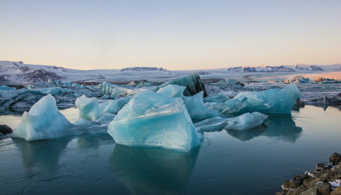
The scene can appear almost unreal. Blue and white icebergs float quietly in the lagoon, dark volcanic mountains rise behind them, and the glacier forms an immense frozen backdrop. Nearby, pieces of ancient glacier ice can wash onto the black sands of Breiðamerkursandur, creating the famous landscape often called Diamond Beach.
But this is more than a beautiful photographic destination. Breiðamerkurjökull and Jökulsárlón provide an unusually visible record of glacial change. The lagoon itself is geologically young and has expanded as the glacier has retreated. Scientists can study the changing landscape, while visitors can observe the interaction between ice, water, sediment, wildlife, and the ocean in one relatively compact area.
What Is Breiðamerkurjökull?
Breiðamerkurjökull is an outlet glacier of Vatnajökull, Iceland’s enormous ice cap. An outlet glacier is a flowing extension of an ice cap or ice sheet that transports ice from higher elevations toward lower terrain.
Vatnajökull dominates a large portion of southeastern Iceland and is the country’s largest ice cap. Iceland’s Institute of Natural History states that glaciers cover roughly 11% of Iceland, while Vatnajökull covers approximately 7,900 square kilometres.
Breiðamerkurjökull flows southward from Vatnajökull toward Breiðamerkursandur. At its lower end, the glacier calves into Jökulsárlón, releasing blocks of ice into the lagoon.
This connection is important because it means the glacier and lagoon are not two unrelated attractions. They are parts of one constantly changing glacial system.
The glacier supplies the ice.
The lagoon receives and transports it.
The river carries water and smaller pieces of ice toward the sea.
The Atlantic then returns some of that ice to the nearby black-sand coastline.
This creates an extraordinary natural cycle that can be observed within a relatively small area.
How Jökulsárlón Was Formed
Jökulsárlón is a proglacial lagoon, meaning a body of water that has formed directly in front of a glacier.
Unlike ancient lakes that have existed for thousands or millions of years, Jökulsárlón is surprisingly young.
According to Iceland’s Institute of Natural History, the lagoon first appeared around 1933, as Breiðamerkurjökull began retreating from the area. As the glacier withdrew, meltwater accumulated in the deep depression left behind by glacial erosion.
The lagoon is therefore an excellent example of how retreating glaciers can transform a landscape.
A glacier does not simply disappear and leave empty ground behind. As it retreats, it can expose valleys, sediments, channels, ridges, and depressions. Water may collect in these newly exposed areas, creating lakes and lagoons.
In Jökulsárlón’s case, the glacier had excavated a deep basin beneath the ice. As the glacier moved backward, meltwater filled this depression.
The lagoon is still evolving today.
A Lagoon That Continues to Change
One of the most fascinating characteristics of Jökulsárlón is that it is not a finished geological feature.
The lagoon continues to change as Breiðamerkurjökull retreats.
The Institute of Natural History describes Jökulsárlón as a young lake that is still forming. Recent measurements cited by the institute put its maximum depth at about 248 metres, making it Iceland’s deepest lake according to those measurements.
This depth helps explain why the lagoon has such a dramatic appearance. The water occupies a deep glacially carved depression, while the glacier remains visible at the northern end.
As the glacier changes, the shape and size of the lagoon can also change. New areas of land may become exposed, water channels can shift, and sediments are transported across the surrounding outwash plain.
This makes the area particularly valuable for scientific observation.
Instead of looking only at ancient geological evidence, researchers can watch glacial landscape evolution while it is happening.
Why Are There So Many Icebergs?
The icebergs in Jökulsárlón originate from Breiðamerkurjökull.
When glacier ice reaches the lagoon, pieces can break away in a process known as calving. These fragments range from relatively small chunks to enormous blocks.
Once separated from the glacier, the icebergs float in the lagoon.
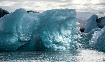
Their appearance varies considerably. Some are brilliant white, while others have striking blue tones. Some pieces contain dark volcanic sediment or trapped debris, producing patterns of black, grey, white, and blue.
The blue color of glacier ice is not simply a reflection of the sky. Dense glacier ice absorbs much of the red portion of visible light while allowing more blue light to be transmitted and scattered back toward the observer.
Fresh snow, air bubbles, density, and the age and structure of the ice can all affect its appearance.
This is why no two icebergs look exactly alike.
Why Glacier Ice Can Be So Old
One of the most fascinating aspects of the icebergs is that the ice may have spent a very long time within the glacier before reaching the lagoon.
Snow accumulated high on the glacier becomes compressed under the weight of newer snow. Over many years, layers of snow gradually transform into dense glacial ice.
That ice then moves slowly through the glacier system.
Eventually, some of it reaches the lower glacier and calves into the lagoon.
In this sense, an iceberg at Jökulsárlón can represent a tiny piece of a much larger and much older history of snowfall and glacier movement.
The floating ice therefore provides visitors with something more meaningful than a spectacular photograph: it is a visible fragment of the glacier’s long journey.
From Lagoon to Ocean
Jökulsárlón is connected to the Atlantic Ocean through a glacial river.
This connection gives the lagoon a remarkable two-stage character.
Inside the lagoon, large icebergs can float for a period of time before moving toward the outlet. Eventually, pieces of ice can enter the river and travel toward the sea.
The journey does not necessarily end there.
Some pieces of ice are carried onto the nearby black-sand beach by waves and tides.
That beach is known internationally as Diamond Beach, although its local geographical setting is Breiðamerkursandur and Fellsfjara. Visit South Iceland explains that ice from the lagoon is carried toward the sea and then washed back onto the beach by the tides.
The Magic of Diamond Beach
The contrast between black volcanic sand and translucent glacier ice creates one of Iceland’s most recognizable natural scenes.
The ice fragments can resemble glass or diamonds when sunlight passes through them. Some pieces are crystal clear, while others have milky white or deep blue interiors.
However, the beach does not look identical every day.
The amount and location of ice depend on factors including tides, weather, currents, and season.
This unpredictability is part of the attraction.
A visit in the morning may look very different from a visit later the same day. Stormy weather can alter the shoreline, while changing tides can move ice from one section of the beach to another.
Breiðamerkursandur: The Landscape Between Ice and Ocean
The larger landscape surrounding Jökulsárlón is known as Breiðamerkursandur, a glacial outwash plain.
An outwash plain is formed when meltwater streams flowing away from a glacier transport sediments such as sand, gravel, and finer particles.
The result is a broad, dynamic landscape shaped by water and ice.
Vatnajökull National Park describes Breiðamerkursandur as one of Iceland’s most accessible landscapes for observing glacial landform development. The area changes particularly rapidly around Breiðamerkurjökull, where the glacier calves into Jökulsárlón.
This means the landscape is effectively an outdoor geological laboratory.
Glacier retreat exposes new ground.
Meltwater moves sediment.
Rivers change their channels.
Vegetation begins colonizing newly exposed surfaces.
Birds establish habitats.
And the coastline continues to redistribute sediment and ice.
Wildlife Around Jökulsárlón
The landscape may appear dominated by ice, but it also supports a variety of wildlife.
Seals are sometimes observed in Jökulsárlón, including animals resting among the floating ice. Sightings vary according to season and conditions, so seeing a seal should be considered a fortunate possibility rather than a guaranteed part of a visit.
The surrounding Breiðamerkursandur is also important for birdlife.
Vatnajökull National Park identifies the area as an important nesting ground for species including great skua and barnacle goose.
This is an important reminder that glacier retreat does not only remove ice. It also creates new environments.
As glaciers withdraw, previously covered ground becomes available for plants, insects, birds, and other organisms. Over time, ecological communities can develop on these young landscapes.
Breiðamerkurjökull and Climate Change
Breiðamerkurjökull is also an important place for understanding modern climate change.
Iceland’s Institute of Natural History reports that Iceland’s glaciers have generally retreated and thinned considerably since the end of the Little Ice Age in the late nineteenth century, with particularly rapid retreat since the mid-1990s associated with a warming climate.
Breiðamerkurjökull provides a particularly visible example.
Its retreat has contributed to the expansion and development of Jökulsárlón.
This creates an interesting paradox: climate-driven glacier loss can produce spectacular new landscapes, but the process represents the reduction of long-term ice storage.
A growing lagoon should therefore not automatically be interpreted as a positive sign.
The lagoon exists partly because the glacier has been retreating.
Why Jökulsárlón Is Important for Science
The area offers scientists an opportunity to study several processes simultaneously.
Glacier retreat
Researchers can monitor changes at the glacier terminus and compare its position through time.
Ice calving
The lagoon provides a natural setting for studying how glacier ice breaks away and how icebergs behave after calving.
Sediment transport
Meltwater carries sediment away from the glacier and redistributes it across Breiðamerkursandur.
Ecosystem development
Newly exposed land allows scientists to observe ecological succession and the gradual establishment of life.
Water and landscape evolution
As the glacier retreats, the shape of the lagoon, river system, and surrounding terrain can continue to change.
Vatnajökull National Park notes that scientific research in the region examines both landscape development and the colonization of newly available environments.
Visiting Jökulsárlón
Jökulsárlón is located beside Route 1, Iceland’s Ring Road, making it one of the more accessible major glacier attractions in the country.
Vatnajökull National Park states that Jökulsárlón and Fellsfjara are located on either side of Route 1 and that the region is accessible year-round.
Visitors can enjoy the lagoon from the shore, walk around designated areas, or join organized boat experiences when operating.
The area is especially attractive to photographers because the scenery changes constantly.
Light reflects from the water and ice.
Clouds alter the color of the glacier.
The sun can turn blue ice almost turquoise.
Winter darkness creates a completely different atmosphere from the long days of summer.
Boat Tours on the Lagoon
During appropriate seasons and conditions, boat tours provide another way to experience Jökulsárlón.
Rather than observing the icebergs only from the shore, visitors can travel among them with an organized tour.
The experience can provide a closer view of the structure and color of the ice, as well as a different perspective on the relationship between the lagoon and glacier.
However, the lagoon is a dynamic natural environment. Icebergs can roll, rotate, break apart, or move unexpectedly.
For this reason, visitors should follow the instructions of professional operators and never attempt to approach floating ice independently.
Safety Around Ice and Water
The beauty of Jökulsárlón can make the environment appear calm and harmless, but glacier landscapes demand respect.
Visitors should never walk onto floating ice in the lagoon. Local tourism guidance warns that ice can roll over or break apart without warning.
The same principle applies to the beach.
Pieces of ice lying on black sand may look solid and inviting, but visitors should not climb onto them. Ice near the ocean can move unexpectedly, and waves can reach farther up the beach than expected. Visit South Iceland specifically advises visitors to keep away from ice close to the sea and watch for unexpected waves.
A safe visit is therefore one where the ice is admired rather than climbed.
Best Conditions for Photography
Jökulsárlón offers opportunities throughout the year, but each season creates a different visual experience.
Summer
Long daylight hours provide plenty of time for photography. The surrounding landscape is also easier to explore during extended daylight.
Autumn
Changing weather and lower-angle light can create dramatic reflections and atmospheric conditions.
Winter
Winter can produce especially striking contrasts between snow, blue ice, dark water, and black sand. Short daylight hours also create opportunities for moody landscapes.
Spring
Spring combines increasing daylight with a landscape transitioning out of winter.
Regardless of season, Icelandic weather can change quickly, so photographers should prioritize appropriate clothing and safe conditions over getting a particular photograph.
Jökulsárlón as a Lesson in Glacial Geography
One reason this destination is so valuable is that it makes complicated geological processes easy to understand.
Standing beside Jökulsárlón, you can observe the entire sequence:
Vatnajökull → Breiðamerkurjökull → glacier retreat → calving → Jökulsárlón → river → Atlantic Ocean → black-sand beach.
That sequence connects an enormous ice cap with a glacier, lagoon, river, ocean, and coastal environment.
Few landscapes make the relationship between these systems so visually obvious.
The Future of Breiðamerkurjökull and Jökulsárlón
The future appearance of this landscape will depend partly on how the climate evolves and how Breiðamerkurjökull responds.
If the glacier continues to lose mass and retreat, the lagoon and surrounding landscape may continue changing. New sections of the glacier bed may become exposed, while the lagoon and drainage system could evolve.
At the same time, glacier behavior is not controlled by temperature alone. Snow accumulation, precipitation, glacier geometry, ice flow, surface conditions, and other factors all influence glacier mass balance.
What is certain is that Breiðamerkurjökull and Jökulsárlón are dynamic.
The landscape seen today is not necessarily the landscape that future visitors will encounter.
Why This Landscape Matters
Breiðamerkurjökull and Jökulsárlón are often described through their beauty: blue icebergs, black sand, mountains, and glacial water.
But their importance goes much deeper.
They demonstrate how glaciers shape the land.
They show how meltwater transports sediment.
They reveal how retreating ice can create new lakes and habitats.
They provide scientists with a natural laboratory for studying rapid environmental change.
And they remind visitors that landscapes can be both breathtaking and temporary.
Jökulsárlón is not simply a lagoon filled with icebergs. It is a visible chapter in the ongoing story of Iceland’s glaciers.
Final Thoughts
Breiðamerkurjökull and Jökulsárlón offer one of the clearest places in Iceland to witness the meeting of ice, water, land, and ocean.
The glacier supplies the ice. The lagoon gathers the calved icebergs. Meltwater carries material toward the sea. Tides return pieces of ice to the black sands of Breiðamerkursandur. Meanwhile, wildlife establishes itself across landscapes newly revealed by retreating ice.
The result is a destination that combines spectacular scenery with extraordinary scientific and geological importance.
For travelers, the experience is unforgettable because the landscape feels alive and constantly changing. For scientists, it provides a natural record of glacier retreat and landscape evolution. And for anyone interested in Earth’s changing climate, it offers a powerful opportunity to see environmental transformation with their own eyes.
The icebergs of Jökulsárlón may look timeless, but the landscape around them is continually being rewritten by moving ice, flowing water, changing climate, and the relentless forces of nature.