 by
1. Why Antarctica’s Ice Loss Matters to the Entire Planet
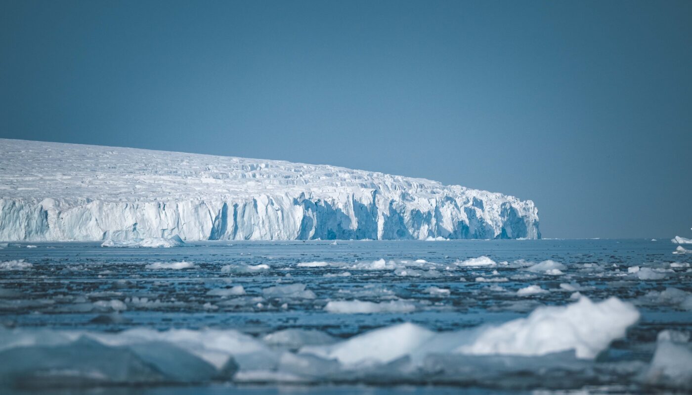
Antarctica holds the largest mass of land ice on Earth. Although temperatures remain extremely low across much of the continent, its ice sheet is not completely stable. Ocean warming, changes in snowfall, and the movement of glaciers all influence how much ice Antarctica gains or loses.
Satellite observations show that Antarctica lost an average of approximately 135 billion metric tons of ice annually between 2002 and 2025. The resulting water contributed to global sea-level rise. The losses have not occurred uniformly: substantial declines in West Antarctica have outweighed modest gains in some parts of East Antarctica.
This matters because ice stored on land eventually adds water to the ocean when it melts or flows into the sea. The greater the net loss of land ice, the more water becomes available to raise global sea levels.
However, Antarctica is only one part of the wider picture. Additionally, as ocean water warms, it expands, and extra meltwater is contributed by glaciers in other areas. These processes operate together, increasing the pressure on coastlines around the world.
The consequences may unfold over decades and centuries rather than appearing everywhere at once. Some communities will experience more frequent flooding first, while other locations may face gradual shoreline retreat, saltwater intrusion, or costly changes to infrastructure.
Understanding Antarctica’s influence therefore requires looking beyond the continent itself. The future of a glacier in the Southern Hemisphere can affect decisions about housing, transportation, agriculture, and environmental protection thousands of kilometers away.
2. How Melting Antarctic Ice Raises Sea Levels
The relationship between Antarctic ice loss and rising seas may seem straightforward, but the underlying process involves several different mechanisms.
The first is the transfer of land ice into the ocean. Snow accumulates across Antarctica and gradually becomes compacted into ice. Glaciers transport that ice toward the coast, where it may flow into the sea. If the amount of ice leaving the continent exceeds the amount replaced by snowfall, the ice sheet loses mass.
Sea levels increase as a result of land-based ice entering the ocean. This differs from the melting of floating sea ice, which already displaces approximately its own weight in seawater and therefore has little direct effect on sea level when it melts.
A second mechanism involves ocean warming. Seawater expands as its temperature increases, taking up more space. Consequently, the ocean can rise even without additional meltwater from Antarctica.
The third factor is the movement of ocean water and the changing shape of the Earth. Sea level does not rise equally at every location, because the distribution of water is influenced by gravity, ocean circulation, and changes in the land beneath the water.
These processes help explain why Antarctic ice loss is such an important subject for climate science. Its effects depend not only on how much ice disappears but also on how the ocean and the solid Earth respond.
3. Why Rising Seas Do Not Affect Every Coastline Equally
One of the most interesting aspects of Antarctic ice loss is that its effects are geographically uneven.
It may seem reasonable to expect every coastline to experience the same increase in sea level when a large amount of ice melts. In reality, the ocean responds to changes in the distribution of mass across the planet.
Large ice sheets exert a gravitational pull on nearby seawater. When an ice sheet loses mass, that pull weakens. Water previously drawn toward the ice begins to redistribute, and the land beneath the ice can also rise as the weight is reduced.
Scientists refer to the resulting geographic pattern as a sea-level fingerprint. Different ice sheets produce different patterns because they occupy different locations and have different shapes and masses.
For Antarctica, this means that sea level near the continent can fall relative to other regions as its ice mass decreases, while some distant coastlines experience a greater-than-average rise.
This does not mean that Antarctic ice loss is harmless to the surrounding region or that every distant coastline will rise by the same amount. Local sea-level changes also depend on ocean currents, wind patterns, vertical land movement, and other sources of ice melt.
For coastal planners, this distinction is important. A global average provides a useful overview, but decisions about flood protection and future construction require regional and local projections.
4. Low-Lying Cities Could Face More Frequent Flooding
One of the clearest ways Antarctic ice loss could reshape coastlines is by increasing the risk of flooding in low-lying urban areas.
Cities located near the sea often contain roads, ports, railway lines, airports, power facilities, and residential neighborhoods built only a short distance above normal water levels. Even a gradual rise in the sea can reduce the safety margin that protects these places during high tides and storms.
As the baseline water level rises, waves and storm surges can reach farther inland. Areas that previously flooded only during exceptional weather may begin experiencing water on roads or in public spaces more frequently.
Flooding can also disrupt services far beyond the immediate shoreline. A flooded transport route may prevent workers from reaching their jobs, while damaged electrical systems can interrupt businesses and emergency services.
The financial consequences can accumulate over time. Municipal governments may need to improve drainage, strengthen protective barriers, elevate roads, or redesign vulnerable public facilities.
In some locations, repeated flooding may eventually make existing buildings too expensive to maintain. Property owners and governments could face difficult decisions about repairs, relocation, and restrictions on future development.
These challenges will not be caused by Antarctica alone. The total effect will reflect the combined influence of global sea-level rise, local land movement, storms, and coastal geography. Nevertheless, continued Antarctic ice loss is an important factor in assessing long-term urban flood risk.
5. Beaches May Become Narrower and More Vulnerable
Beaches are constantly changing environments. Waves transport sand along the shore, tides move water across the beach, and storms can remove large quantities of sediment within a short period.
Rising sea levels can alter this balance by allowing waves to reach farther inland. As the waterline moves landward, the beach may lose part of the area that was previously exposed during ordinary tides.
Some beaches can naturally migrate inland when sufficient undeveloped space and sediment are available. Others are trapped between the sea and roads, buildings, seawalls, or cliffs. In these places, the beach may become narrower because it cannot shift landward freely.
The process is often described as coastal squeeze when natural habitats or shorelines become compressed between rising water and fixed human structures.
Tourism-dependent communities may feel the effects particularly strongly. Beaches support hotels, restaurants, recreational activities, and local employment. Losing attractive shoreline areas can affect both the environment and the local economy.
However, sea-level rise does not automatically mean every beach will disappear. The outcome depends on wave energy, sediment supplies, geology, coastal development, and management practices.
Restoring dunes, protecting natural sediment movement, and limiting construction in vulnerable areas can help some beaches adapt. Where the shoreline is already heavily developed, more substantial interventions may be necessary.
6. Coastal Erosion Could Accelerate
Coastal erosion occurs when waves, currents, and other natural processes remove material from the shoreline. It is a normal part of coastal evolution, but rising sea levels can increase the pressure on vulnerable locations.
As water reaches higher sections of the coast, waves may attack cliffs, dunes, and shore protection structures that previously experienced less exposure. During storms, higher water levels can allow waves to carry sediment away from beaches and coastal banks.
Soft coastlines composed of sand, clay, or loosely consolidated sediment are particularly susceptible to erosion, although the extent of the damage varies greatly between locations.
The consequences can be serious for communities living near unstable shorelines. Houses may require additional protection, roads may become unsafe, and recreational land may gradually disappear.
Erosion can also damage cultural sites and historic buildings located close to the water. In some places, these sites cannot easily be moved or reconstructed elsewhere.
Hard engineering structures such as seawalls and barriers may protect selected sections of coast, but they can also alter wave patterns and sediment transport. Without careful planning, protecting one area may increase erosion or reduce beach width nearby.
A sustainable response therefore requires understanding how the entire shoreline behaves rather than treating every stretch of coast as an isolated problem.
7. Island Nations Could Face Serious Challenges
Low-lying island nations are especially exposed to rising sea levels because much of their land, infrastructure, and economic activity is concentrated close to the ocean.
For these communities, the danger is not limited to permanent inundation. Higher water levels can increase the reach of storm waves, worsen coastal erosion, and allow seawater to enter freshwater systems.
On islands that depend on thin freshwater lenses beneath the ground, saltwater intrusion can threaten drinking water and agriculture. Saltwater can also damage crops and change the chemical conditions of coastal soils.
Communities may need to invest in rainwater storage, improved drainage, coastal defenses, and more resilient buildings. These measures can be difficult to finance, particularly for countries with small populations and limited public resources.
In the longer term, some communities may need to consider moving homes or essential facilities away from the most exposed locations. Such decisions involve more than engineering. Land can carry deep cultural, historical, and family significance, making relocation emotionally and socially complex.
The specific future of each island depends on its elevation, geology, freshwater resources, exposure to storms, and capacity to adapt. It would be inaccurate to suggest that all island nations will disappear. However, rising seas can make life increasingly difficult even before land becomes permanently submerged.
8. Saltwater Could Threaten Freshwater and Agriculture
Coastal communities depend on freshwater for drinking, sanitation, farming, and industry. Rising sea levels can threaten these resources when seawater moves into rivers, wetlands, groundwater systems, and agricultural soils.
In some coastal aquifers, freshwater naturally sits above denser saltwater. If sea levels rise or groundwater is overused, the boundary between the two can shift, allowing saltwater to move farther inland.
The consequences may be particularly serious for farms situated on low-lying coastal plains. Irrigation water containing excessive salt can reduce crop yields, while accumulated salt in the soil can make cultivation more difficult.
Flooding may also leave salt deposits behind, especially where drainage is poor. Farmers may need to change crops, improve water management, or restore damaged soils before returning land to productive use.
Communities could face rising costs as they seek alternative water supplies. Some may need desalination facilities or expanded rainwater collection systems, while others may have to protect existing wells from contamination.
These challenges illustrate how changes in sea level can influence food security and public health. A coastline is not merely a boundary between land and ocean; it is part of a larger system that supports freshwater, agriculture, and human settlement.
9. Wetlands and Mangroves Could Lose Valuable Habitat
Coastal wetlands, salt marshes, and mangrove forests provide essential benefits to both wildlife and people. They offer habitat for fish and birds, store carbon, stabilize sediment, and help reduce the energy of waves.
Rising sea levels can place these environments under pressure. Some wetlands can survive by accumulating sediment and gradually increasing their elevation. Others may migrate inland if suitable land is available.
However, roads, seawalls, buildings, and other barriers can prevent this natural movement. When rising water leaves a wetland with nowhere to expand, the habitat may shrink or disappear.
Mangrove forests are particularly important in many tropical and subtropical regions because their tangled roots stabilize shorelines and provide shelter for young fish. Where the rate of sea-level rise exceeds the ability of mangroves to adjust, or where coastal development blocks inland migration, these ecosystems can be threatened.
Wetland loss also affects people. Reducing natural buffers may expose nearby communities to stronger waves and increased erosion, while damage to fish habitats can affect local livelihoods.
Protecting coastal ecosystems should therefore be part of sea-level adaptation. Restoring wetlands and allowing natural shoreline movement can complement engineered defenses and provide benefits that extend beyond flood protection.
10. Could Antarctica’s Ice Loss Change Coastlines for Centuries?
One of the most important features of ice-sheet change is its long timescale.
Antarctica is an enormous ice system, and its response to warming can continue long after temperatures begin to stabilize. Some changes develop over decades, while others involve the slow movement of glaciers, the retreat of ice-sheet margins, and the adjustment of the underlying land.
Scientists pay particular attention to parts of West Antarctica, where sections of the ice sheet rest on bedrock below sea level. In certain regions, the ground beneath the ice slopes downward inland, creating conditions in which retreat can become self-reinforcing.
As the grounding line—the boundary where a glacier begins to float—moves inland into deeper water, thicker ice may be exposed to ocean conditions that allow greater ice discharge. This process can contribute to further retreat.
Floating ice shelves also matter because they can help restrain the glaciers feeding them. If an ice shelf thins or breaks apart, the land-based ice behind it may flow more quickly into the sea.
These mechanisms are complex, and scientists continue to improve the models used to predict them. The Antarctic contribution to future sea-level rise remains one of the major uncertainties in long-term projections.
The key point is that future coastal changes may continue for generations. Even if emissions are reduced, some sea-level rise is already committed by the warming that has occurred and by the slow response of the climate and ice-sheet systems.
11. How Scientists Monitor Antarctica and Changing Coastlines
Understanding future coastal risk requires accurate observations of both the Antarctic Ice Sheet and the world’s oceans.
Satellites help scientists measure changes in ice-sheet mass, surface elevation, glacier movement, and sea-surface height. Gravity-measuring satellites can estimate changes in the amount of ice stored on land, while radar and laser instruments provide information about ice and ocean surfaces.
Researchers also use ocean measurements to investigate the temperatures and circulation patterns that influence ice shelves from below. Field observations and improved maps of the bedrock beneath Antarctica help scientists understand which regions may be especially vulnerable to retreat.
Along coastlines, tide gauges record water levels relative to the land, while satellite altimeters measure changes in the ocean surface across much larger areas. GPS and other geodetic measurements help researchers determine whether land is rising or sinking.
These different sources of information are combined with climate and ice-sheet models to produce future projections. The results help governments estimate flood hazards, plan infrastructure, and evaluate different adaptation strategies.
Improving observations is especially important because large uncertainties remain about how quickly particular Antarctic regions may lose ice and how those changes will affect individual coastlines. Better data can help communities make more informed decisions.
12. What Coastal Communities Can Do to Prepare
Although no community can stop Antarctic ice loss by itself, preparation can reduce the damage caused by rising seas.
The first step is to identify vulnerable areas. Flood maps, elevation surveys, historical records, and future sea-level projections can help governments determine which neighborhoods and facilities face the greatest risks.
Second, new development should account for future conditions. Avoiding construction in highly exposed locations can reduce future costs and prevent people from becoming dependent on expensive protective structures.
Third, communities can strengthen natural defenses. Healthy wetlands, dunes, mangroves, and other coastal ecosystems may reduce erosion and wave energy while providing important habitat.
Fourth, carefully designed engineering measures can protect critical infrastructure where necessary. Depending on local conditions, these measures may include improved drainage, raised roads, flood barriers, and strengthened seawalls.
Finally, governments should consider managed retreat where long-term protection becomes impractical. Moving people and infrastructure away from areas facing severe and persistent risks is difficult, but early planning can provide better outcomes than waiting until repeated disasters force emergency decisions.
Reducing greenhouse gas emissions remains essential as well. Lower future warming can limit additional ice loss and reduce the long-term scale of sea-level rise, although it cannot eliminate all future coastal change.
Conclusion
Antarctica’s ice loss could reshape coastlines around the world through a combination of rising sea levels, changing ocean conditions, and the gradual transformation of coastal environments.
Low-lying cities may face more frequent flooding, beaches may become narrower, and erosion may threaten roads, homes, and historic sites. Island communities could experience saltwater intrusion, while wetlands and mangrove forests may struggle to survive when rising water leaves them insufficient space to move inland.
The effects will vary from one region to another because sea level is influenced by gravity, ocean circulation, land movement, and local geography. Some coastlines may experience greater-than-average increases, while others may respond differently. This is why regional projections are essential for effective planning.
Antarctica’s future will be shaped partly by decisions made today. Reducing emissions, improving scientific observations, protecting coastal ecosystems, and planning infrastructure for future conditions can help limit the risks.
The distant Antarctic wilderness and the world’s inhabited coastlines are more closely connected than they first appear. What happens to the ice at the bottom of the world can influence where people live, how ecosystems survive, and how communities prepare for the future.